Hunters Point
| Site Name: | Hunters Point | 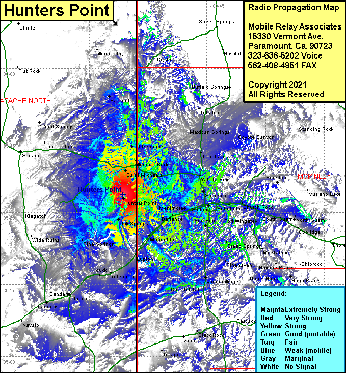 Hunters Point Coverage |
| Latitude: | 035 33 36.3N | 35.5600833 |
| Longitude: | 109 06 27.3W | -109.1075833 |
| Feet | Meters | |
| Ground Elevation: | 7394.0 | 2,253.7 |
| HAAT: | 462.1 | 140.9 |
| City: | St Michaels | |
| County: | Apache North | |
| State: | Arizona |
This is not an MRA Owned Site. For space rental contact the site owner.
Do you own or manage this site? Click Here
Would you like to add a site to the Google Earth Map?? Click Here
Site Coverage: Coverage of Hunters Point, Saint Michael, Window Rock, Fort Defiance, Sawmill, Crystal, Tohatchi, Mexican Springs, Twin Lakes, Yah-Ta-Hey, Gamerco, Church Rock, Rehoboth, Gallup, Red Rock, Allison, Twin Buttes, Manuelito, Lupton, Allentown, Houck, Chetco, Sanders, Chambers, Chi Chil Tah, Vander Wagen, Upper Nutria, Boon Place, Coolidge, South Guam, North Guam, Iyanbito