Mt Princeton
| Site Name: | Mt Princeton | 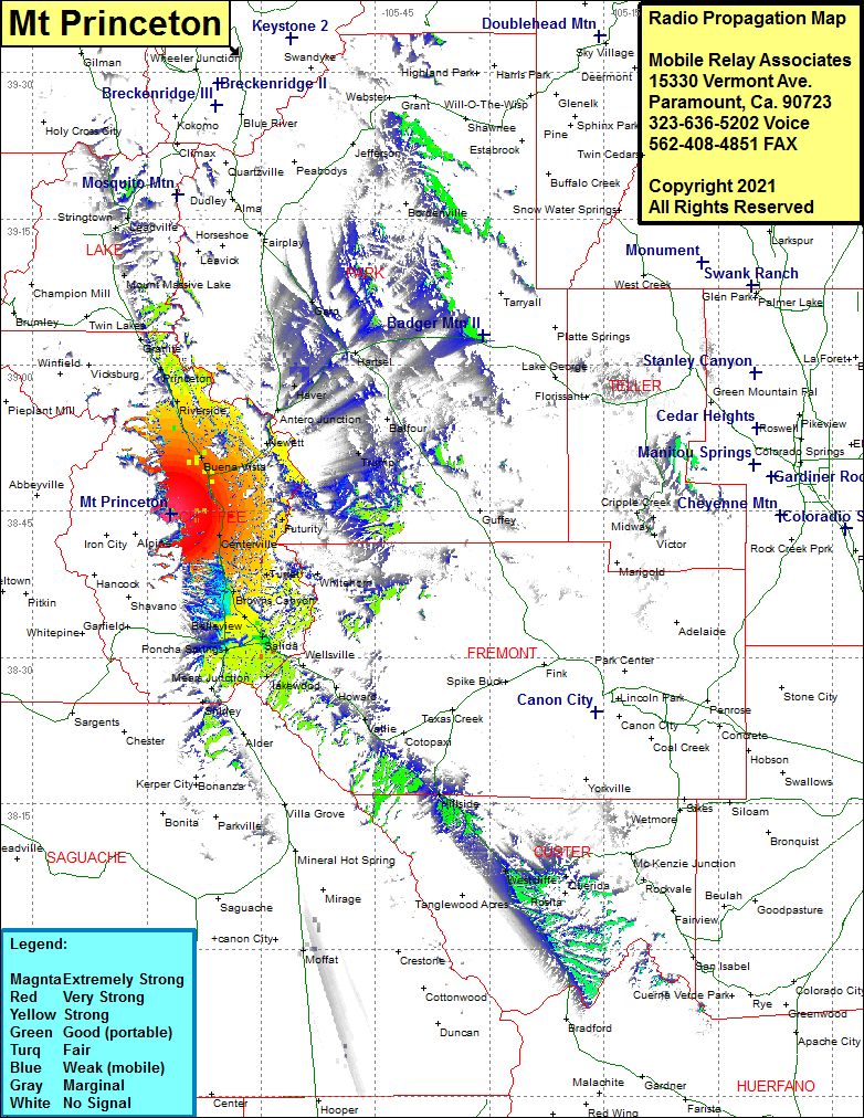 Mt Princeton Coverage |
| Latitude: | 038 44 45.0N | 38.7458333 |
| Longitude: | 106 11 56.0W | -106.1988889 |
| Feet | Meters | |
| Ground Elevation: | 10890.0 | 3319.3 |
| HAAT: | 1167.5 | 355.9 |
| City: | Buena Vista | |
| County: | Chaffee | |
| State: | Colorado |
This is not an MRA Owned Site. For space rental contact the site owner.
Do you own or manage this site? Click Here
Would you like to add a site to the Google Earth Map?? Click Here
Site Coverage: Coverage of Buena Vista, Americus, Riverside, Princeton, Granite, Nathrop, Centerville, Turret, Borwns Canyon, Smeltertown, Poncha Springs, Salida, Wellsville, Vallie, Hillside, Westcliffe, Querida, Haver, Garo