Ricks College
| Site Name: | Ricks College | 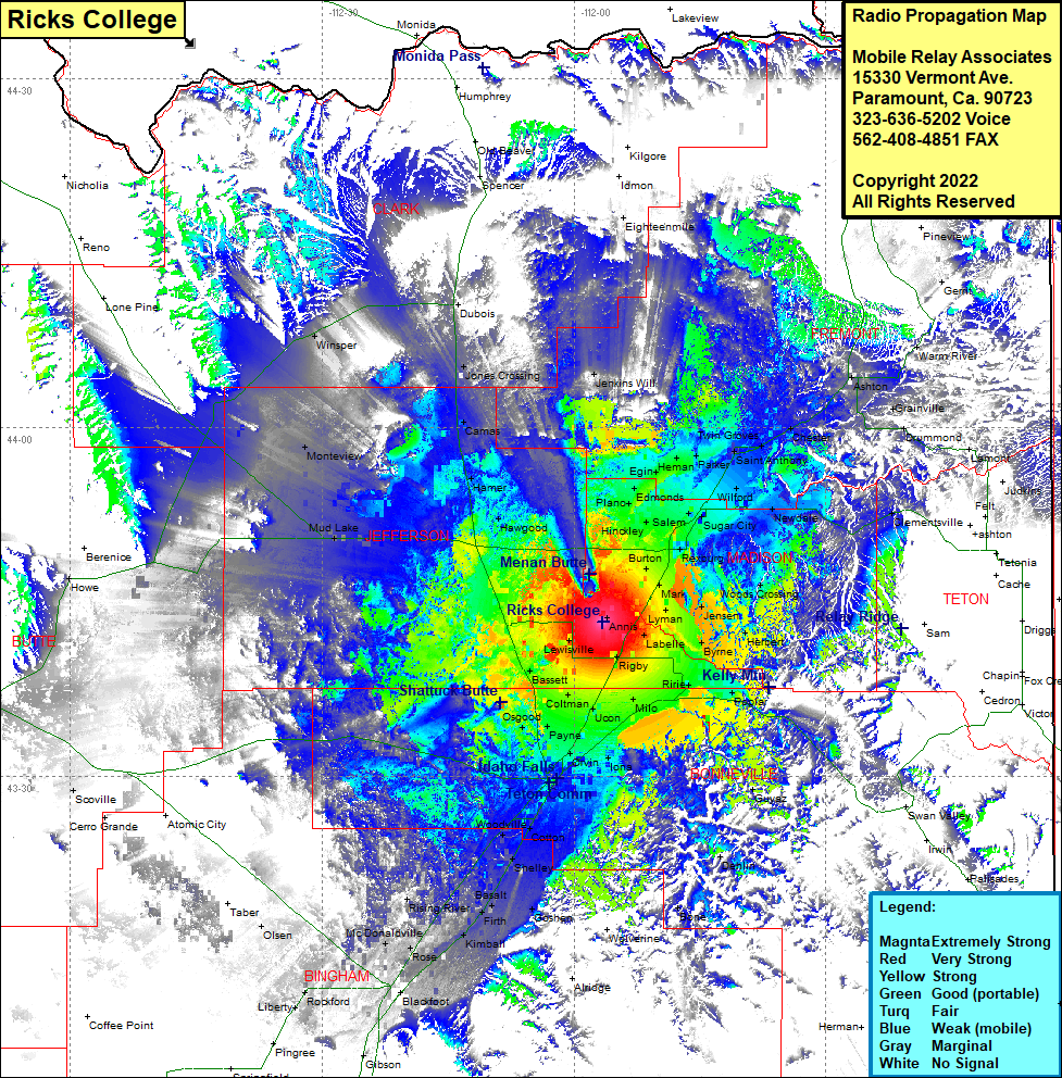 Ricks College Coverage |
| Latitude: | 043 43 17.5N | 43.7215278 |
| Longitude: | 111 56 34.0W | -111.9427778 |
| Feet | Meters | |
| Ground Elevation: | 4971.0 | 1,515.2 |
| HAAT: | 212.5 | 64.8 |
| City: | Lewisville | |
| County: | Jefferson | |
| State: | Idaho |
This is not an MRA Owned Site. For space rental contact the site owner.
Do you own or manage this site? Click Here
Would you like to add a site to the Google Earth Map?? Click Here
Site Coverage: Coverage of Annis, Jenkins Will, Eighteenmile, Burton, Hibbard, Plano, Edmonds, Egin, Herman, Twin Groves, Saint Anthony, Chester, Ashton, Warm River, Gerrit, Grainville, Drummond, Lamont, Felt, Wilford, Sugar City, Newdale, Rexburg, Walker, Woods Crossing, Thornton, Jensen, Herbert, Archer, Byrne, Poplar, Guyaz, Dehlin, Bone, Rigby, Milo, Grant, Bassett, Coltman, Payne, Ucon, Iona, Orvin, Osgood, Idaho Falls, Woodville, Cotton, Shelley, Gerrard, Basalt, Firth, Rising River, Kimball, Goshen, Arken, McDonaldville, Blackfoot, Gibson, Rockford, Liberty, Olsen, Howe, Mud Lake, Monteview, Hawgood, Haqmer, Camas, Jones Crossing, Winsper, Dubois