Mt Moses
| Site Name: | Mt Moses | 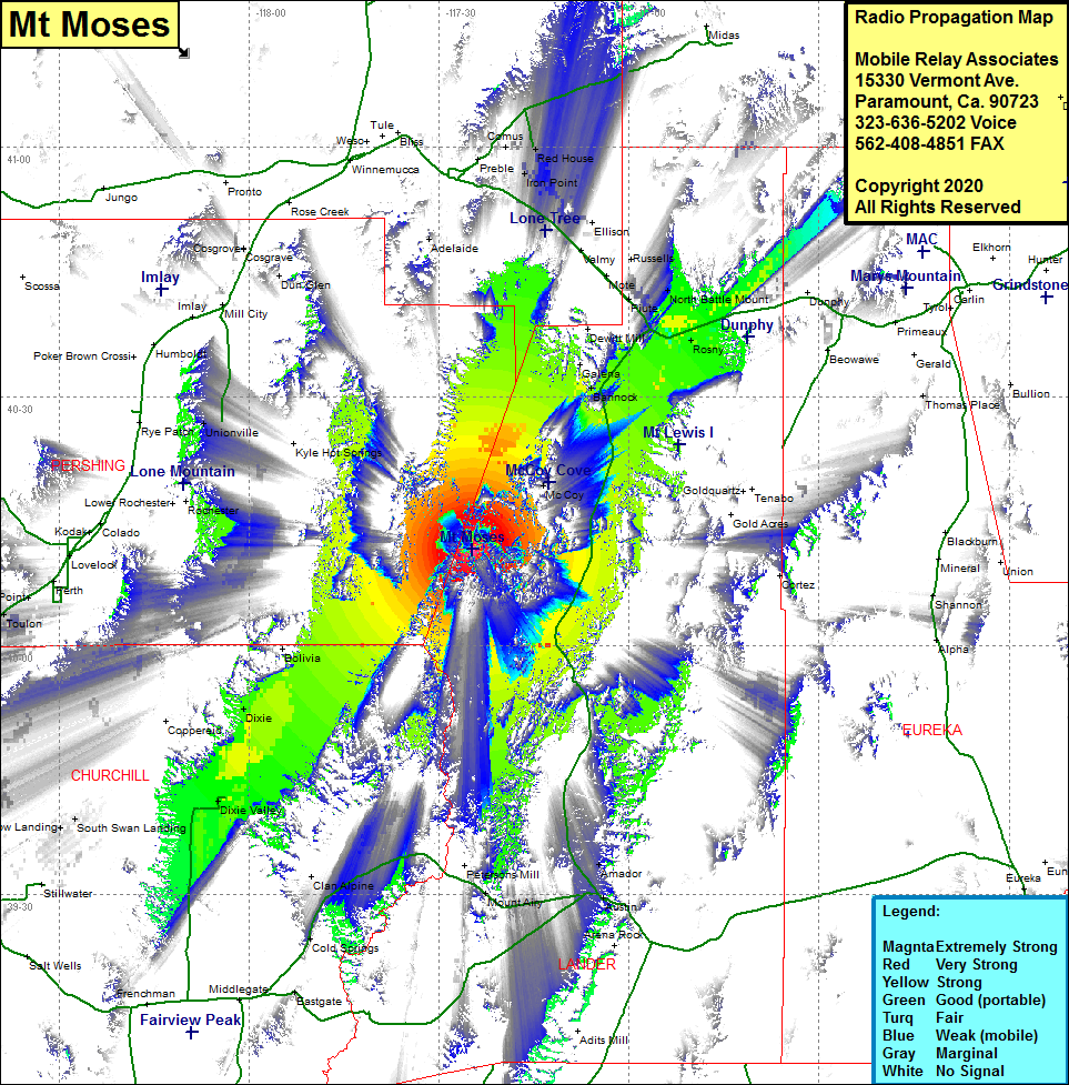 Mt Moses Coverage |
| Latitude: | 040 11 37.4N | 40.1937222 |
| Longitude: | 117 24 39.7W | -117.4110278 |
| Feet | Meters | |
| Ground Elevation: | 8412.0 | 2564.0 |
| HAAT: | 2821.8 | 860.1 |
| City: | McCoy | |
| County: | Lander | |
| State: | Nevada |
This is not an MRA Owned Site. For space rental contact the site owner.
Do you own or manage this site? Click Here
Would you like to add a site to the Google Earth Map?? Click Here
Site Coverage: Coverage of the northwest portion of Lander County, Bannock, Galena, McCoy, Rosny, Dixie Valley, Dixie, portions of Nevada Highway 305 from Austin to Interstate 80 at Battle Mountain, Interstate 80 from 1 mile west of Battle Mountain to 10 miles east of Battle Mountain, Rock Creek Road for about 30 miles