Chase Mtn
| Site Name: | Chase Mtn | 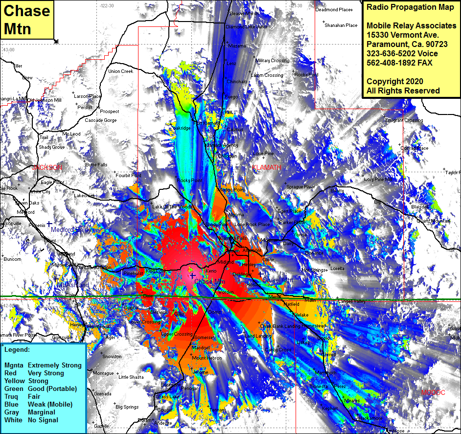 Chase Mtn Coverage |
| Latitude: | 042 05 40.3N | 42.0945278 |
| Longitude: | 121 59 37.9W | -121.9938611 |
| Feet | Meters | |
| Ground Elevation: | 6347.0 | 1934.6 |
| HAAT: | 1976.0 | 602.3 |
| City: | Keno | |
| County: | Klamath | |
| State: | Oregon |
This is not an MRA Owned Site. For space rental contact the site owner.
Do you own or manage this site? Click Here
Would you like to add a site to the Google Earth Map?? Click Here
Site Coverage: Coverage of Teeters Landing, Midland, Texum, Keno, Dorns, Somerset, MacDoel, Upper Crossing, Gillis, Beswick, Dixie, Worden, Altamont, Hager, Pine Grove, Henley, Gem, Stuken, Dehlinger, Hasley, Lost River, Merrill, Malone, Ainsworth Corner, Kalina, Malin, Adams Point, Tulelake, Tuber, Dalton, Hornestead, Newell, Capic, Liskey, Kandra, Chalk Bank Landing, Lorella, Canby Cross, Mammoth, Cornel, Perez, Meares, Tionesta, Kephart, Hollenbeck, Hackamore, Boles, Ambrose, Klamath Falls, Pelican City, Wocus, Shady Pine, Algoma, Modoc Point, Rocky Point, Snowdon, Montague, Grenada, Hawkinsvile, Yreka, Calimus, Kirk, Fuego, Chinchalo, Lenz, Mazama, Military Crossing, Lamm Crossing, Diamond Lake Jct, Beaver Marsh, Rocky Ford