Otter
| Site Name: | Otter | 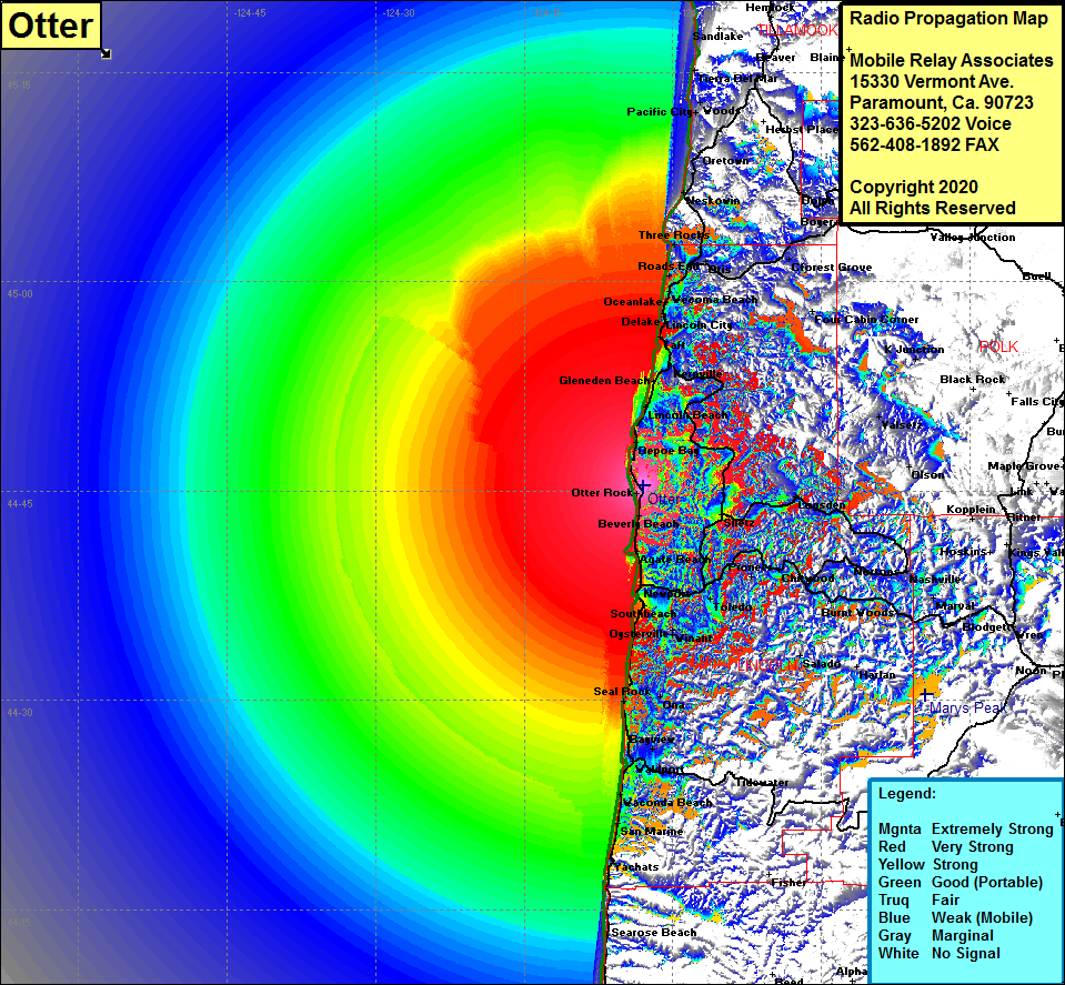 Otter Coverage |
| Latitude: | 044 45 22.8N | 44.7563333 |
| Longitude: | 124 02 57.3W | -124.0492500 |
| Feet | Meters | |
| Ground Elevation: | 1044.0 | 318.2 |
| HAAT: | 1084.4 | 330.5 |
| City: | Beverly Beach | |
| County: | Lincoln | |
| State: | Oregon |
This is not an MRA Owned Site. For space rental contact the site owner.
Do you own or manage this site? Click Here
Would you like to add a site to the Google Earth Map?? Click Here
Site Coverage: Coverage of Otter Rock, Beverly Beach, Agate Beach, Newport Heights, Fruitvale, Newport, Southbeach, Yaquina, Toledo, Moody, Burpee, Elk City, Pioneer, Chitwood, Eddyville, Oysterville, Winant, Holiday Beach, Salado, Holiday Beach, Ona, Seal Rock, Bayview, Waconda Beach, San Marine, Depoe Bay, Lincoln Beach, Melco Landing, Gleneden Beach, Mowrey Landing, Morgan Landing, Mack Landing, Sunset Landing, Kernville, Cutler City, Taft, Nelscott, Lincoln City, Delake, Oceanlake, Wiacoma Beach, Neotsu, Roads End, Otis Jct, Otis, Three Rocks, Neskowin, Rose Lodge, Minski Place, K Jct, Cforest Grove, Boyer, Dolph