Wendover Peak
| Site Name: | Wendover Peak | 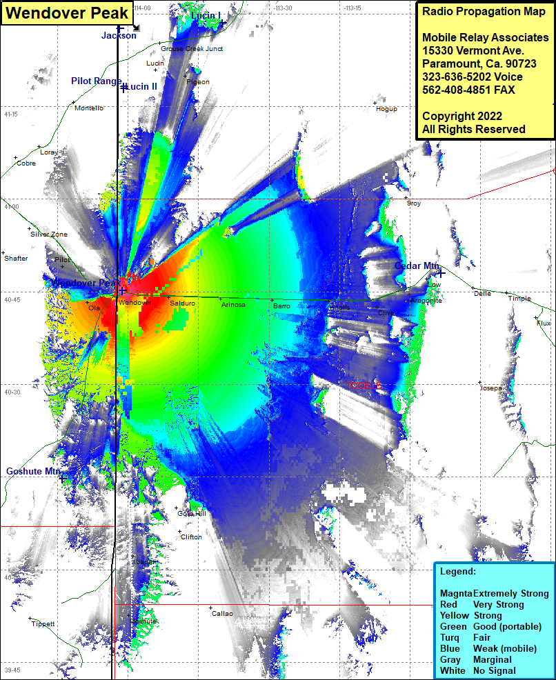 Wendover Peak Coverage |
| Latitude: | 040 45 13.6N | 40.7537778 |
| Longitude: | 114 01 11.1W | -114.0197500 |
| Feet | Meters | |
| Ground Elevation: | 5069.0 | 1545.0 |
| HAAT: | 555.2 | 169.2 |
| City: | Wendover | |
| County: | Tooele | |
| State: | Utah |
This is not an MRA Owned Site. For space rental contact the site owner.
Do you own or manage this site? Click Here
Would you like to add a site to the Google Earth Map?? Click Here
Site Coverage: Coverage of Pigeon, Aragonite, Blair, Silsbee, Salduro, Arinosa, Barro, Knolls, Clive, Ibapah, Goshute, Ola, Pilot, Proctor