Creston Jct
| Site Name: | Creston Jct | 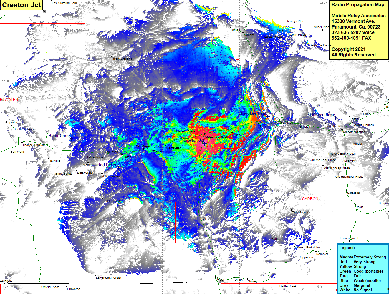 Creston Jct Coverage |
| Latitude: | 041 40 51.4N | 41.6809444 |
| Longitude: | 107 43 30.9W | -107.7252500 |
| Feet | Meters | |
| Ground Elevation: | 7,190.0 | 2,191.5 |
| HAAT: | 216.7 | 66.0 |
| City: | Wamsutter | |
| County: | Sweetwater | |
| State: | Wyoming |
This is not an MRA Owned Site. For space rental contact the site owner.
Do you own or manage this site? Click Here
Would you like to add a site to the Google Earth Map?? Click Here
Site Coverage: Coverage of Bairoil, Lamont, Dorr Place, Marvin Place, Cherokee, Riner, Hadsell, Rawlins, Sinclair, Fort Steele, Meads, Modway, Dad, Twin Groves, Tullis, Fort LaClede, J O Junction, Monell, Table Rock, Robinson, Tipton, Red Desert, Frewan, Warmsutter, Hadsell Place, Rocky Crossing