Select Page

Tejon Summit

Chris at Tejon Summit
Site Name:Tejon SummitTejon Summit 34.802902 -118.815420 Coverage
Latitude:034 48 10.3N34.8028611
Longitude:118 48 55.3W-118.8153611
 FeetMeters
Ground Elevation:48841,488.6
Support Structure Height:257.6
Height With Appurtences:5015.2
HAAT:1020.3311.0
Antenna Height For HAAT:49.014.9
Type of Facility:Prefab Building & Tower
Address:Gorman Post Road
City:Gorman
County:Los Angeles
State:California
Existing Callsign:WQYN485
Backup Generator:None
Backup Battery:525Ah
Temp Control:Air Cond
Cable Entry:Cord Grips
Method of Cable Attachment:Strut & Snap-In
Method of Antenna Mounting:Custom
Security:Alarm & Cameras
Land Owner:Private

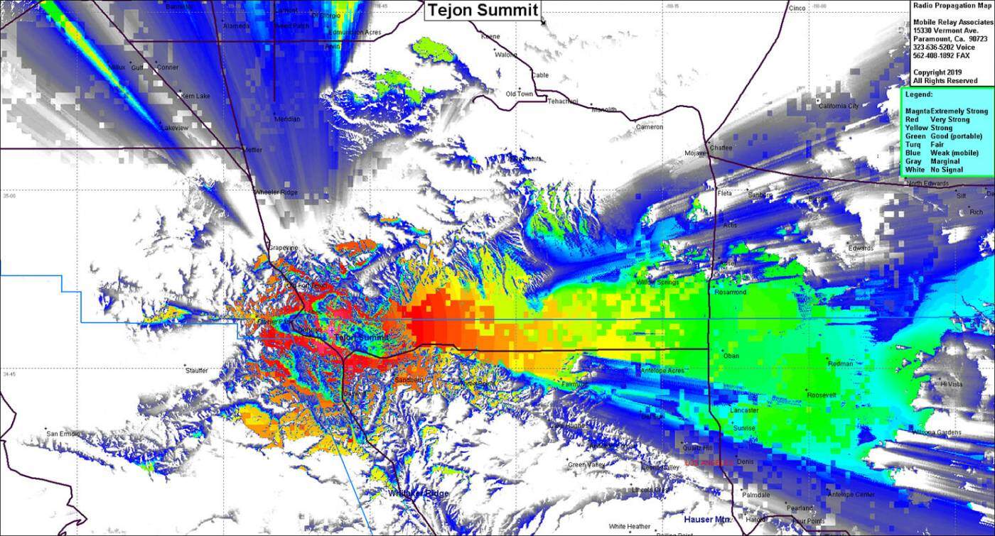
Site Coverage: This site provides coverage into Gorman, Frazier Park, the western high desert, Interstate 5 from 20 miles south of Gorman to 20 miles north of Gorman

Tejon Summit Radio building
Repeaters at Tejon Summit
Tejon Summit Coverage Map

0 0 votes
Article Rating
Subscribe
Notify of
guest
Your Name
Your Email
0 Comments
Inline Feedbacks
View all comments
The owner of this website has made a commitment to accessibility and inclusion, please report any problems that you encounter using the contact form on this website. This site uses the WP ADA Compliance Check plugin to enhance accessibility.
0
Would love your thoughts, please comment.x
()
x