Las Yeguas
| Site Name: | Las Yeguas | 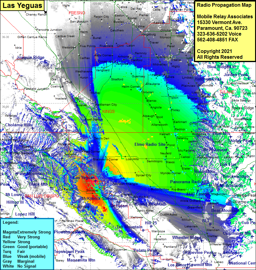 Las Yeguas Coverage |
| Latitude: | 035 26 26.7N | 35.4407500 |
| Longitude: | 119 57 24.2W | -119.9567222 |
| Feet | Meters | |
| Ground Elevation: | 3350.0 | 1021.1 |
| HAAT: | 1265.3 | 385.7 |
| City: | McKittrick | |
| County: | Kern | |
| State: | California |
This is not an MRA Owned Site. For space rental contact the site owner.
Do you own or manage this site? Click Here
Would you like to add a site to the Google Earth Map?? Click Here
Site Coverage: Coverage of Simmler, La Panza, Martinez Place, Todd Place, Wilson Corner, Templeton, Linne, Whitley Gardens, Shandon, Cholame, Estrella, Welsona, San Miguel, Old Adobe, Annette, Kecks Corner, Blackwells Corner, Reef Station, Avenal, Hydril, Kettleman City, Murray, Stratford, Turk, Huron, Westhaven, Calflax, Vanguard, Westside, Five Points, Burrel, Riverdale, Schilling, Halls Corner, Cimarron, San Joaquin, Helm, Caruthers, Rasin City, Bowles, Easton, Fowler, Lone Star, Del Rey, Parlier, Wahtoke, Nevelencia, Orange Cove, Orosi, Dinuba, Tokay, Reedley, London, Traver, Peral, Rayo, Wimp, Monson, Traver, Kingsburg, Selma, Lucerne, Shirley, Armona, Lemoore, Hanford, Guernsey, Clint, Laton, Helm Corner, Corcoran, Waukena, Paige, Tulare, Loma, Higby, Visalia, Midvalley, Goshen, Ivanhoe, Sequoia, Rayo, Auckland, Orange Cove, Lori, Ivanhoe, Exeter, Burr, Tonyville, Lindsay, Strathmore, Plainview, Lisko, Woodville, Poplar, Elmco, Deer Creek Colony, Poterville, Terra Bella, Ducor, Orris, Vestal, Jovista, Delano, Jasmin, Vinland, McFarland, Calico, Famoso, Slater, Cawelo, Richgrove, Halfway House, Bakersfield, Kern City, Stevens, Old River, Weed Patch, Lamont, Panama, Wible Orchard, Edison, Bena, Di Giorgio, Old River, Millux, Conner, Kern lake, Lakeview, Meridian, Mettler, Wheeler Ridge, Dustin Acres, Valley Acres
Amateur (ham) frequencies: