Cedar Mtn
| Site Name: | Cedar Mtn | 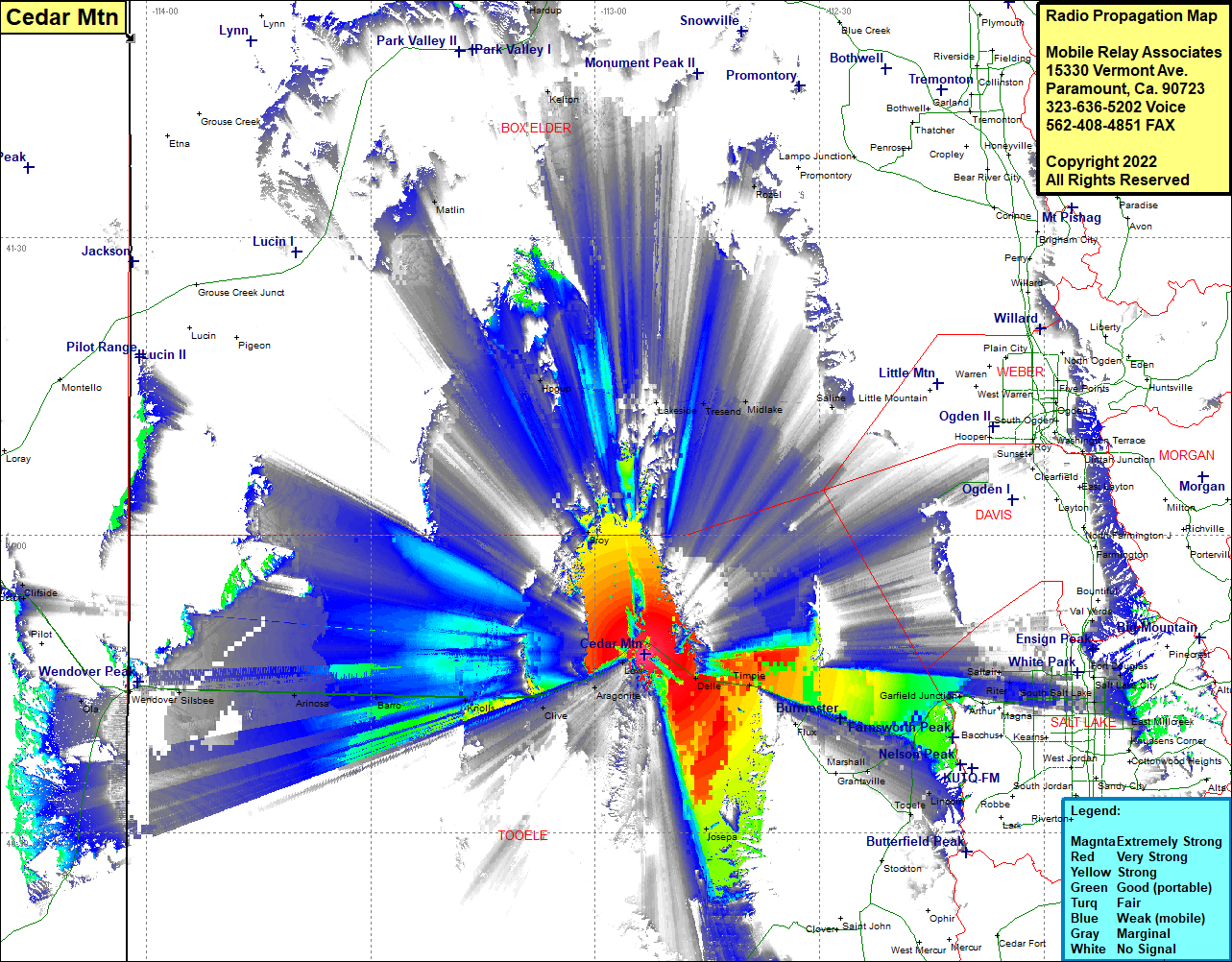 Cedar Mtn Coverage |
| Latitude: | 040 47 58.5N | 40.7995833 |
| Longitude: | 112 53 18.9W | -112.8885833 |
| Feet | Meters | |
| Ground Elevation: | 5328.0 | 1624.0 |
| HAAT: | 676.8 | 206.3 |
| City: | Delle | |
| County: | Tooele | |
| State: | Utah |
This is not an MRA Owned Site. For space rental contact the site owner.
Do you own or manage this site? Click Here
Would you like to add a site to the Google Earth Map?? Click Here
Site Coverage: Coverage of Aragonite, Clive, Knolls, Barro, Arinosa, Salduro, Blair, Roy, Hogup, Matlin, Lakeside, Rozel, Garfield Junction, Mills Junction, Timpie, Delle, Iosepa, Flux, Marshall, Burmester, Lago, Lake Point Junction, Lake Point, Erda, Lincoln, Angels Grove, Saltair, Riter, Terminal, Redwood, Roper, Sugar House, Fort Douglas, University Village, Foothill Village, East Millcreek, Val Verda