Enterprise
| Site Name: | Enterprise | 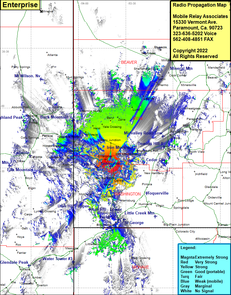 Enterprise Coverage |
| Latitude: | 037 30 35.6N | 37.5098889 |
| Longitude: | 113 39 34.3W | -113.6595278 |
| Feet | Meters | |
| Ground Elevation: | 7211.0 | 2197.9 |
| HAAT: | 1303.1 | 397.2 |
| City: | Enterprise | |
| County: | Washington | |
| State: | Utah |
This is not an MRA Owned Site. For space rental contact the site owner.
Do you own or manage this site? Click Here
Would you like to add a site to the Google Earth Map?? Click Here
Site Coverage: Coverage of Enterprise, Old Irontown, Iron Mountain, Pine Valley, Central, Central East, Veyo, Gunlock, Santa Clara, St George, Atkinville, Bloomington, Islen, Barclay, Crossroads, Brown, Crestline, Horseshoe Bend, Uvada, Ninemile Rocks, Cold Spring, Caselton, Ursine, Modena, Heist, Yale Crossing, Beryl, Zane, Lund, Latimer, Thermo, Laho, Upton, Berry Junction, Fort Johnson, Iron Springs, Enoch, Cedar City, Summit, Parovan, Paragonah