Jones Ridge
| Site Name: | Jones Ridge | 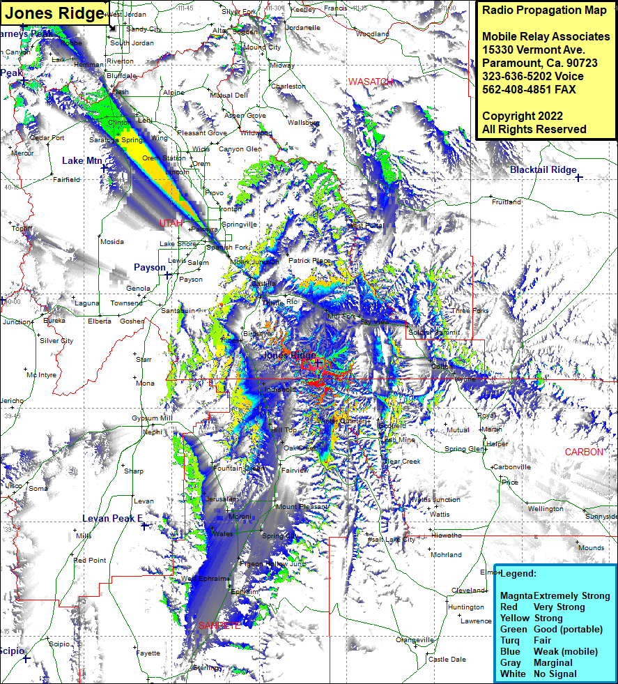 Jones Ridge Coverage |
| Latitude: | 039 50 53.9N | 39.8483056 |
| Longitude: | 111 19 51.6W | -111.3310000 |
| Feet | Meters | |
| Ground Elevation: | 9344.0 | 2848.1 |
| HAAT: | 1670.2 | 509.1 |
| City: | Pines | |
| County: | Utah | |
| State: | Utah |
This is not an MRA Owned Site. For space rental contact the site owner.
Do you own or manage this site? Click Here
Would you like to add a site to the Google Earth Map?? Click Here
Site Coverage: Coverage of Mill Fork, Sky View, Gilluly, Soldier Summit, Colton, Three Forks, West Portal, Utah Mine, Clear Creek, Wattis Junction, Elmo, Mounds, Columbia Junction, East Carbon City, Sunnyside, Sunnyside Junction, Indianola, Hill Top, Oak Creek, Fairview, Mount Pleasant, Spring City, Chester, Pigeon Hollow Junction, West Ephraim, Ephraim, Wales, Freedon, Jerusalem, Fountain Green, Sterling, Maple Grove, Aurora, Redmond, Axtell, Centerfield