Lake Mountain
| Site Name: | Lake Mountain |  Lake Mountain Coverage |
| Latitude: | 040 16 26.8N | 40.2741111 |
| Longitude: | 111 56 35.6W | -111.9432222 |
| Feet | Meters | |
| Ground Elevation: | 7678.0 | 2340.3 |
| HAAT: | 2800.4 | 853.6 |
| City: | Clinton | |
| County: | Utah | |
| State: | Utah |
This is not an MRA Owned Site. For space rental contact the site owner.
Do you own or manage this site? Click Here
Would you like to add a site to the Google Earth Map?? Click Here
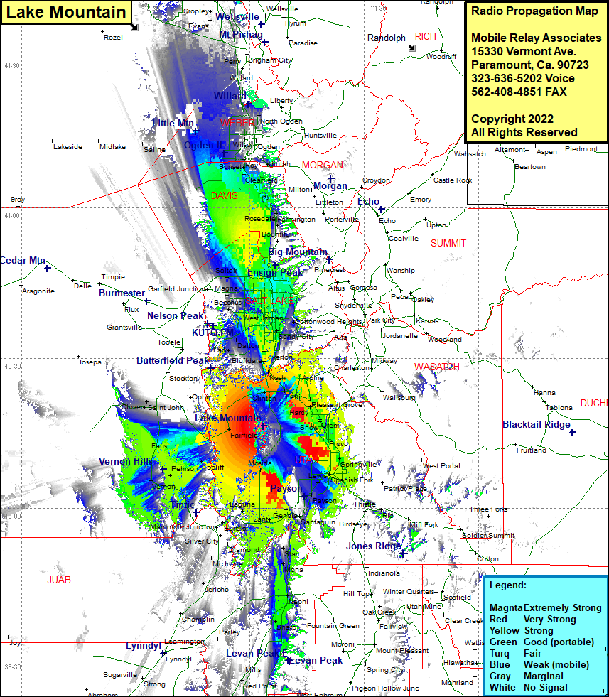
Site Coverage: Coverage of Mosida, Fairfield, Toplift, Faust, Pehrson, Vernon, Lofgreen, Mammoth Junction, Eureka, Dividend, Laguna, Homansville, Lant, Elberta, Goshen, Ganola, Santaquin, Spring Lake, Payson, Benjamin, Lake Shore, Palmyra, Spanish Fork, Sutro, Leland, Salem, Mapleton, Springville, Ironton, Provo, Pleasant View, Edgemont, Lincoln, Orem, Tintic Junction, Diamond, McIntyre, Dennis, Gypsum Mill, Nephi, Sharp, Levan, Red Point, Jerico, Champlin, Saint John, Clover, Cedar Fort, Mercur, Clinton, Lehi, Saratoga Springs, Orem Station, Orem, Snow, Edgemont, Caryhurst, Wicks, Nunns, Lindon, Pleasant Grove, Alpine, Nash, Bluffdale, Herriman, Draper, South Jordan, Welby, Copperton, Bacchus, West Jordan, South Jordan, Granite, Sandy City, Atwood, Cottonwood Heights, Knudsens Corner, Holladay, Bennion, Kearns, East Millcreek, Roper, Granger, Hunter, Magna, South Salt Lake, Terminal, Saltair, Salt Lake City, Fort Douglas, West Bontiful, Valencia, Farmington, North Farmington, Fruit Heights, West Kaysville, Layton, East Layton, Clearfield, Sunset, West Point, Barnes, Syracuse, Clinton, Roy, Barton, Hooper, Kanesville, Riverdale, Relico, Taylor, West Weber, Wilson, Marriott, Five Points, Harrisville, North Ogden, Pleasant View, Farr West, West Warren, Warren, Plain City, Little Mountain, Nerva, WIllard, Corinne, Bear River City, Bradford, Evans, Penrose, Lampo Junction, Thatcher, Cropley
