Laketown
| Site Name: | Laketown | 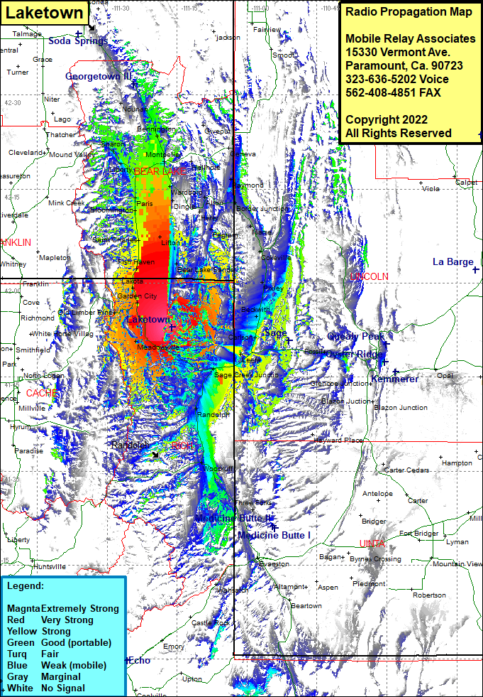 Laketown Coverage |
| Latitude: | 041 52 56.6N | 41.8823889 |
| Longitude: | 111 16 11.5W | -111.2698611 |
| Feet | Meters | |
| Ground Elevation: | 7584.0 | 2311.6 |
| HAAT: | 1172.5 | 357.4 |
| City: | Laketown | |
| County: | Rich | |
| State: | Utah |
This is not an MRA Owned Site. For space rental contact the site owner.
Do you own or manage this site? Click Here
Would you like to add a site to the Google Earth Map?? Click Here
Site Coverage: Coverage of Old Lumber Pine, Garden City, Lakota, Fish Haven, Saint Charles, Lifton, Bloomington, Paris, Ovid, Liberty, Bern, Lanark, Sharon, Arexburg, Montpelier, Bennington, Georgetown, Nounan, Manson, Geneva, Raymond, Border Junction, Border, Wardboro, Dingle, Harer, Alton, Chausse, Marse, Cokeville, Pixley, Beckwith, Pegram, Turnpike, Lifton, Bear Lake Sands, Meadowville, Laketown, Silver Creek Junction, Leele, Sage, Carlson, Randolph, Woodruff, Three Forks, Almy, Wahsatch