Mt Pisgah
| Site Name: | Mt Pisgah | 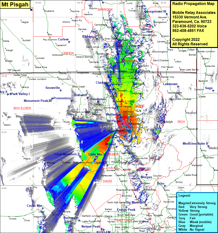 Mt Pisgah Coverage |
| Latitude: | 041 33 03.8N | 41.5510556 |
| Longitude: | 111 56 12.5W | -111.9368056 |
| Feet | Meters | |
| Ground Elevation: | 7141.0 | 2176.6 |
| HAAT: | 1878.6 | 572.6 |
| City: | Brigham | |
| County: | Box Elder | |
| State: | Utah |
This is not an MRA Owned Site. For space rental contact the site owner.
Do you own or manage this site? Click Here
Would you like to add a site to the Google Earth Map?? Click Here
Site Coverage: Coverage of Paradise, Mount Sterling, Wellsville, Hyrum, College Ward, Millville, Providence, Logan, North Logan, Benson, Petersboro, Bothwell, Thatcher, Cropley, Evans, Lampo Junction, Penrose, Hyde Park, Smithfield, Amalga, Cache Junction, Newton, Quigley Crossing, Trenton, Richmond, White Horse Village, Lewiston, Cornish, Morton, Clarkston, Wheelton, Utida, Fairview, Franklin, Cherryville, Whitney, Dayton, Saint Johns, Clifton, Coulam Oxford, Banida, WInder, Riverdale, Treasureton, Swanlake, Red Rock Junction, Niter, Bench, Lago, Thatcher, Mount Sterling, Paradise, Avon, Bringham City, Perry, Nerva, Liberty, Eden, Warren, West Warren, Promontory Point, Saline, Huntsville, Delle, Timpie, Lakeside