Roan Cliffs
| Site Name: | Roan Cliffs | 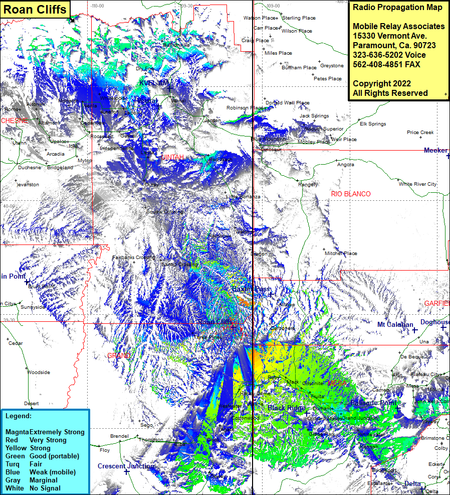 Roan Cliffs Coverage |
| Latitude: | 039 26 32.6N | 39.4423889 |
| Longitude: | 109 09 58.5W | -109.1662500 |
| Feet | Meters | |
| Ground Elevation: | 8443.0 | 2573.4 |
| HAAT: | 1399.2 | 426.5 |
| City: | Three Pines | |
| County: | Grand | |
| State: | Utah |
This is not an MRA Owned Site. For space rental contact the site owner.
Do you own or manage this site? Click Here
Would you like to add a site to the Google Earth Map?? Click Here
Site Coverage: Coverage of Atchee, Watson, Harley Dome, Utaline, Westwater, Ruby, Mack, Loma, Gilsonite, Fruita, Rhone, Appleton, Durham, Redlands, Rosevale, Grand Junction, Orchard Mesa, Pear Park, Johnsons Corner, Clifton, Mount Lincoln, Whitewater, Kannah, Glade Park, Cottonwood, Agate, Cisco, Santio Crossing, Rainbow, Squaw Crossing, Watson, Red Wash, Vernal, Naples, Gusher, Ouray, Leota, Randlett, Fort Duchesne, Cedarview, Bennett, Leeton, Hayden, Neola, Neola, Monarch, Whiterocks, Tridell, Lapoint, Bullionville, Mount Emmons, Altamont, Boneta, Mountain Home, Bluebell, Altonah