Snowville
| Site Name: | Snowville | 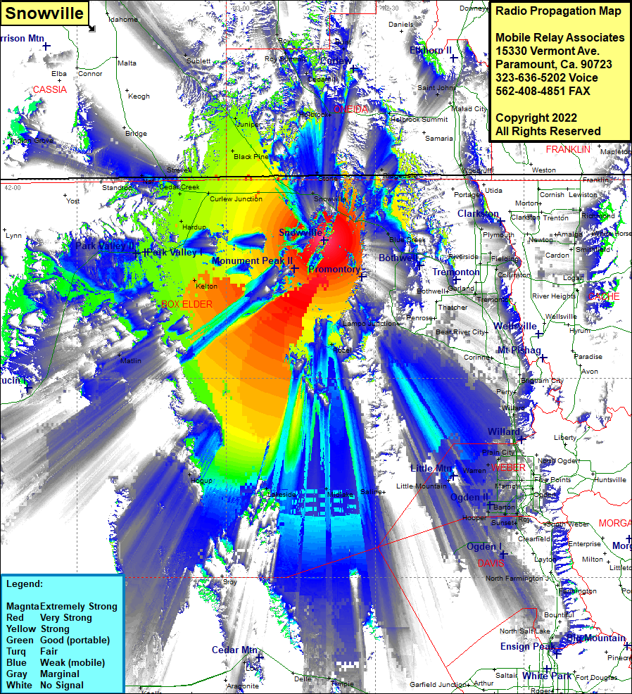 Snowville Coverage |
| Latitude: | 041 50 52.0N | 41.8477778 |
| Longitude: | 112 40 22.7W | -112.6729722 |
| Feet | Meters | |
| Ground Elevation: | 6199.0 | 1889.5 |
| HAAT: | 1286.4 | 392.1 |
| City: | Snowville | |
| County: | Box Elder | |
| State: | Utah |
This is not an MRA Owned Site. For space rental contact the site owner.
Do you own or manage this site? Click Here
Would you like to add a site to the Google Earth Map?? Click Here
Site Coverage: Coverage of Blue Creek, Ridgedale, Pleasantview, Holbrook Summit, Saint Johns, Smithfield, Richmond, Bruist, Arbon Arbon PO, Promontory, Rozel, Lampo Junction, Penrose, Howell, Corinne, Bear River City, Madsea, Tremonton, Riverside, Fielding, Cardon, Hyde Park, North Logan, Greenville, River Heights, Perry, Willard, Nerva, Warren, West Warren, Kanesville, West Weber, Evona, Cozydale, Sunset, Syracuse, Midlake, Rozel, Tresend, Lakeside, Hogup, Metlin, Timpie, Knolls, Barro