Capitol Peak
| Site Name: | Capitol Peak | 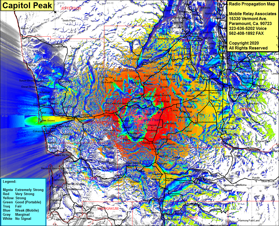 Capitol Peak Coverage |
| Latitude: | 046 58 29.3N | 46.9748056 |
| Longitude: | 123 08 20.8W | -123.1391111 |
| Feet | Meters | |
| Ground Elevation: | 2656.0 | 809.5 |
| HAAT: | 2130.4 | 649.4 |
| City: | Delphi | |
| County: | Thurston | |
| State: | Washington |
This is not an MRA Owned Site. For space rental contact the site owner.
Do you own or manage this site? Click Here
Would you like to add a site to the Google Earth Map?? Click Here
Site Coverage: Coverage of Littlerock, Bordeaux, Mima, Gate, Helsing Jct, Michigan Hill, Fords Prarie, Tono, Bucoda, Sunnydale, Vail, Raineer, Yelm, McKenna, Johnsons Corner, Kellys Korner, Saint Clair, Mock City, Roy, Hillhurst, Loveland, Spanaway, Graham, Tanwax, Suprise Valley, Eatonville, La Grande, Alder, Reliance, Park Jct, Chehalis, Newaukum, Napvine, Evaline, Marys Corner, Onalaska, Cinebar, Alpha, Harmony, Bremer, Klaber, PeEli, McCormick, Lebarn, Menlo, Firdale, Bedford, Oakville, Cedarville, Lakner, Pony, Saginaw, Elma, Satsop, Brady, Montesano, Central Park, East Aberfeen, Hoquim, New London, Frisken Wye, Deckerville, Matlock, Parkland, Monta Vista, South tacoma, Oakland, Manzanita, Maury, Zenith, De Moines, Normandy, Glenwood, Wildwood, Fragaria, West Seattle