Tecopa Peak
| Site Name: | Tecopa Peak | 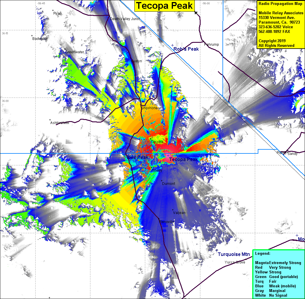 |
| Latitude: | 035 47 07.8N | 35.7855000 |
| Longitude: | 116 08 43.2W | -116.1453333 |
| Feet | Meters | |
| Ground Elevation: | 2,290.0 | 698.0 |
| HAAT: | 414.0 | 126.2 |
| City: | Tecopa | |
| County: | San Bernardino | |
| State: | California |
Would you like to add a site to the Google Earth Map?? Click Here
Site Coverage: Coverage of Tecopa, Dumont, Valjean, Renoville, Shoshone, Evelyn