Cheaha Mtn
| Site Name: | Cheaha Mtn |  Cheaha Mtn Coverage |
| Latitude: | 033 29 15.4N | 33.4876111 |
| Longitude: | 085 48 22.9W | -85.8063611 |
| Feet | Meters | |
| Ground Elevation: | 2389.0 | 728.2 |
| HAAT: | 1503.7 | 458.3 |
| City: | Abel | |
| County: | Cleburne | |
| State: | Alabama |
This is not an MRA Owned Site. For space rental contact the site owner.
Do you own or manage this site? Click Here
Would you like to add a site to the Google Earth Map?? Click Here
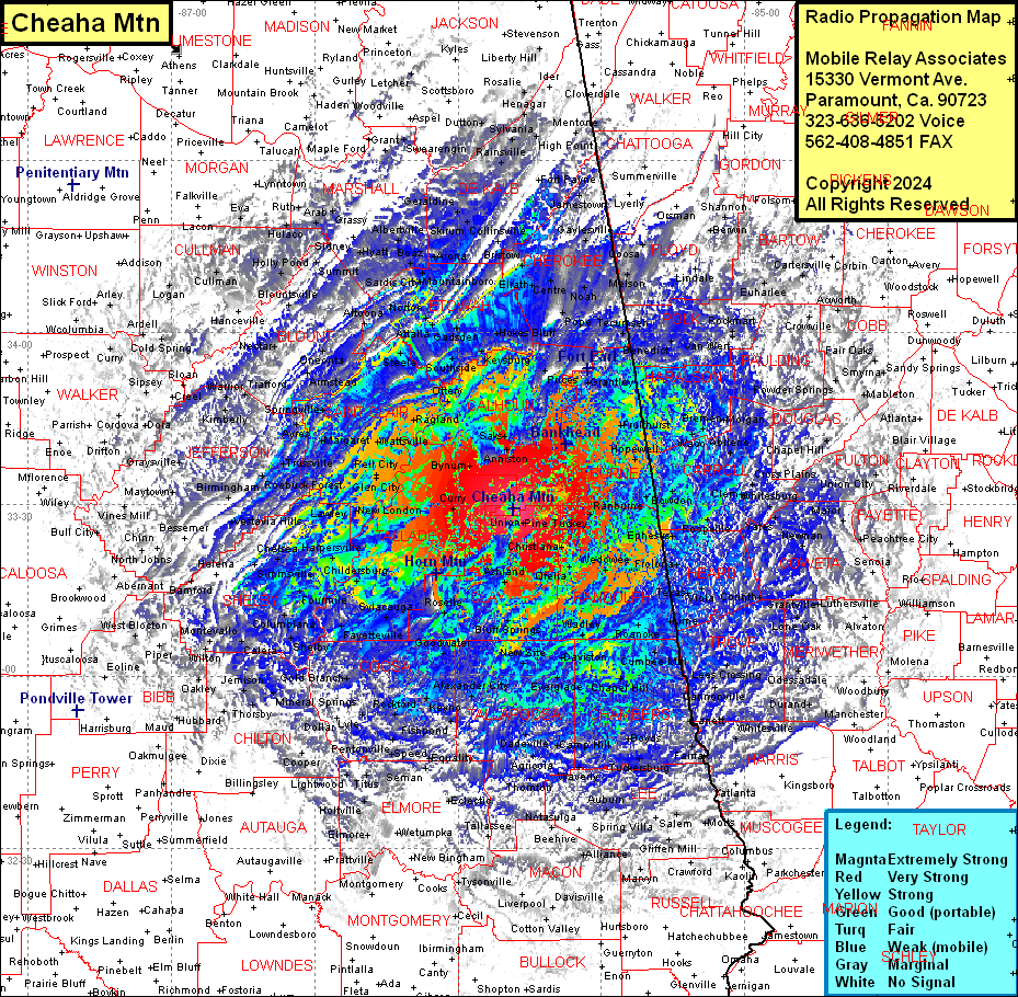
Site Coverage: Coverage of Cleburne County, Haralson County, Carroll County, Heard County, Randolph County, Clay County, Talladega County, Calhoun County,Saint Clair County, Etowah County, Polk County, most of Floyd County, Cherokee County, De Kalb County, Blount County, most of Jefferson County, Coosa County, Tallapoosa County, Clay County, Randolph County, Heard County, Troup County, northwesern Harris County, parts of Elmore & Chilton Counties, most of Shelby County, parts of Bibb County, parts of Macon, Lee, Morgan and Russell Counties
