Aubrey Peak
| Site Name: | Aubrey Peak | 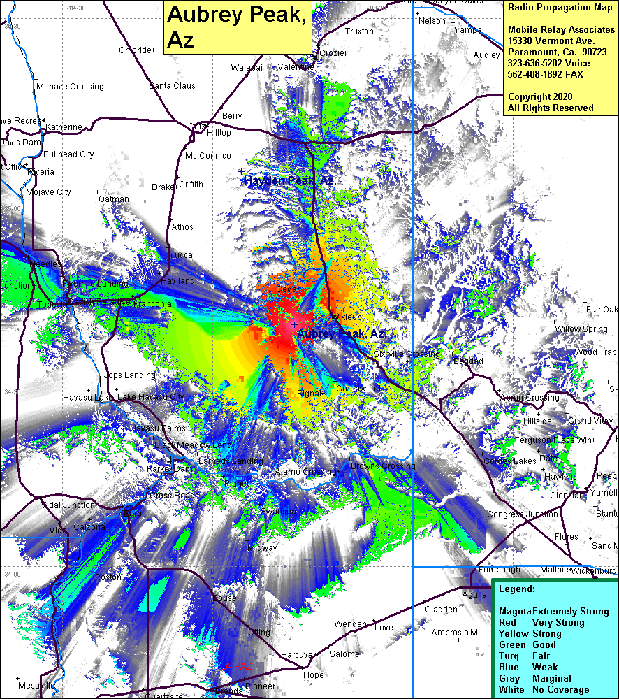 Aubrey Peak Coverage |
| Latitude: | 034 39 47.3N | 34.6631389 |
| Longitude: | 113 43 45.4W | -113.7292778 |
| Feet | Meters | |
| Ground Elevation: | 5083.0 | 1549.3 |
| HAAT: | 1817.1 | 553.9 |
| City: | Wikieup | |
| County: | Mojave | |
| State: | Arizona |
This is not an MRA Owned Site. For space rental contact the site owner.
Do you own or manage this site? Click Here
Would you like to add a site to the Google Earth Map?? Click Here
Site Coverage: Coverage of Wikieup, Cedar, Six Mile Crossing, Bagdad, Greenwood, Signal, Browns Crossing, Alamo Crossing, Swansea, Midway, Planet, Cross Roads, Calzona, Cienega Springs, Franconia, Haviland, Yucca, Parker Jct, Needles