Dragoon Peak
| Site Name: | Dragoon Peak | 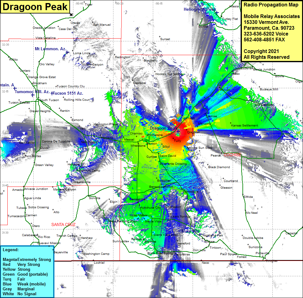 Dragoon Peak Coverage |
| Latitude: | 032 01 06.7N | 32.0185278 |
| Longitude: | 110 05 34.5W | -110.0929167 |
| Feet | Meters | |
| Ground Elevation: | 5499.0 | 1,676.1 |
| HAAT: | 883.3 | 269.2 |
| City: | Dragoon | |
| County: | Cochise | |
| State: | Arizona |
This is not an MRA Owned Site. For space rental contact the site owner.
Do you own or manage this site? Click Here
Would you like to add a site to the Google Earth Map?? Click Here
Site Coverage: Coverage of Dragoon, Manzora, Kansas Settlement, Cochise, Willcox, Raso, Pearce, Tully, Fenner, Pomerene, Benson, Chamiso, Whetstone, Mescal, Curtiss, Saint David, Escalante Crossing, Boquillas, Benson Jct, Fairbank, Tombstone, Charleston, Sierra Vista, Miles Manor, West Pershing Plaza, Campstone, Canelo, Ransey, Bledsoe, Nicksville, Palominas, Huachuca City, Herrington Place, Pantano, Mountain View, New Tucson, Corona De Tucson, Vail