Getz Peak
| Site Name: | Getz Peak | 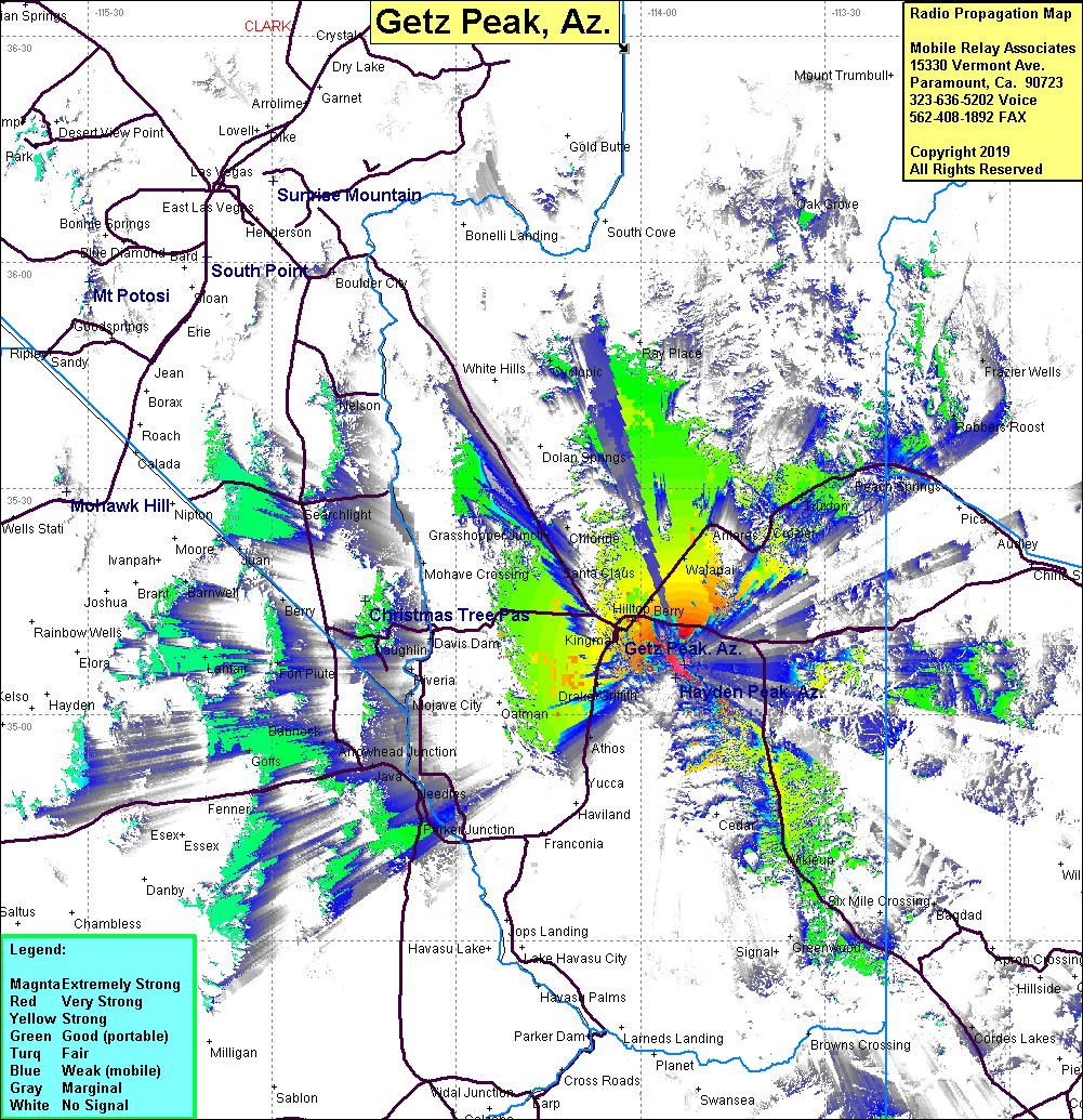 Getz Peak Coverage |
| Latitude: | 035 06 36.9N | 35.1102500 |
| Longitude: | 113 52 58.9W | -113.8830278 |
| Feet | Meters | |
| Ground Elevation: | 7539.4 | 2298.0 |
| HAAT: | 2793.2 | 851.4 |
| City: | Kingman | |
| County: | Mojave | |
| State: | Arizona |
This is not an MRA Owned Site. For space rental contact the site owner.
Do you own or manage this site? Click Here
Would you like to add a site to the Google Earth Map?? Click Here
Site Coverage: Coverage of Hilltop, Stockton, Walapai, Drake, McConnico, Harris, Griffith, Athos, Kingman, Grasshopper Jct, Yucca, Antares, Crozier, Truxton, Valentine, Chloride, Parker Jct, Needles, Arrowhead Jct, Wikieup, Hilltop, Berry, Santa Claus, Mojave Crossing