Guthrie Peak
| Site Name: | Guthrie Peak | 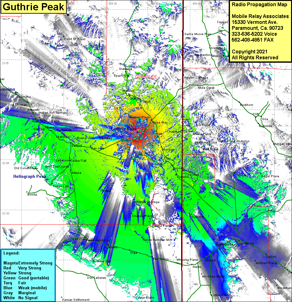 Guthrie Peak Coverage |
| Latitude: | 032 53 12.9N | 32.8869167 |
| Longitude: | 109 18 49.8W | -109.3138333 |
| Feet | Meters | |
| Ground Elevation: | 6547.0 | 1,995.5 |
| HAAT: | 2408.3 | 734.0 |
| City: | Guthrie | |
| County: | Greenlee | |
| State: | Arizona |
This is not an MRA Owned Site. For space rental contact the site owner.
Do you own or manage this site? Click Here
Would you like to add a site to the Google Earth Map?? Click Here
Site Coverage: Coverage of Morenci, Stargo, Clifton, Marques Place, Three Way, York, Sheldon, Fox, Duncan Franklin, Virden, Shakespeare, Lordsburg, Lisbon, Separ, Mitchell Place, Brockman, Cotton City, Mondel, San Simon, Olga, Bowie, Bowie Jct, Luzena, Raso, Willcox, Cochise, Manzoro, Tanque, Chaney Place, Whitlock Cienega, Little Franks, Yellow Hammer Mill, Artesia, Turkey Flat, Lebanon, Cactus Flat, Safford, Thatcher, San Jose, Buena Vista, Glenbar, Pima, Bryce, Eden, Fort Thomas