Haulapai Mtn
| Site Name: | Haulapai Mtn | 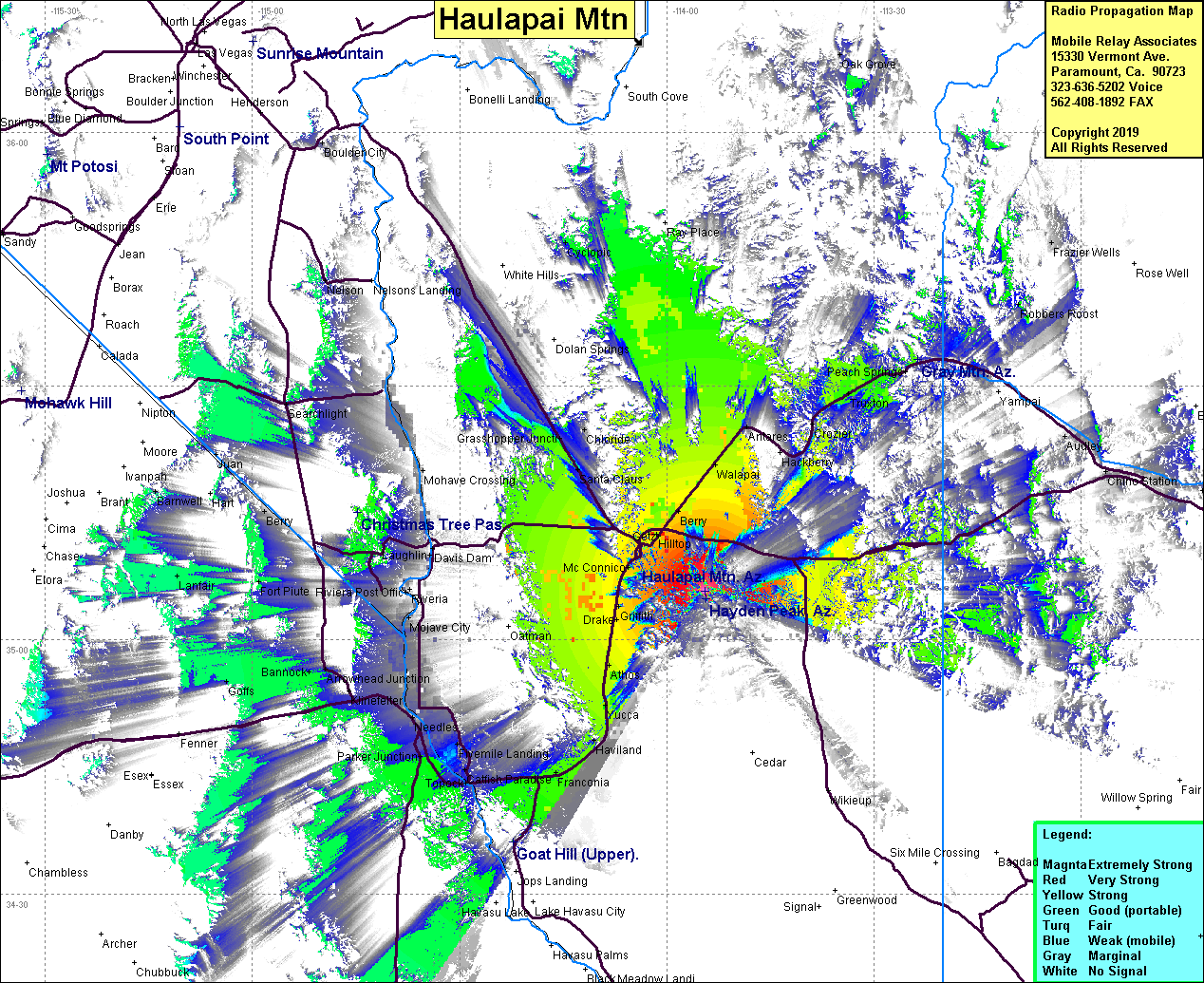 Haulapai Mtn Coverage |
| Latitude: | 035 05 44.4N | 35.0956667 |
| Longitude: | 113 54 25.5W | -113.9070833 |
| Feet | Meters | |
| Ground Elevation: | 7588.6 | 2313.0 |
| HAAT: | 2820.0 | 859.5 |
| City: | Kingman | |
| County: | Mojave | |
| State: | Arizona |
This is not an MRA Owned Site. For space rental contact the site owner.
Do you own or manage this site? Click Here
Would you like to add a site to the Google Earth Map?? Click Here
Site Coverage: Coverage of Hilltop, Stockton, Walapai, Drake, McConnico, Harris, Griffith, Athos, Kingman, Grasshopper Jct, Franconia, Haviland, Yucca, Antares, Crozier, Truxton, Valentine, Chloride, Parker Jct, Needles, Arrowhead Jct