Heliograph Peak
| Site Name: | Heliograph Peak | 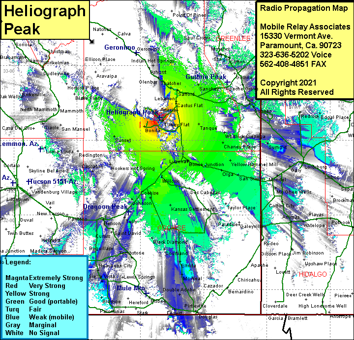 Heliograph Peak Coverage |
| Latitude: | 032 39 00.5N | 32.6501389 |
| Longitude: | 109 50 56.9W | -109.8491389 |
| Feet | Meters | |
| Ground Elevation: | 10040.0 | 3,060.2 |
| HAAT: | 4319.5 | 1316.6 |
| City: | Lebanon | |
| County: | Graham | |
| State: | Arizona |
This is not an MRA Owned Site. For space rental contact the site owner.
Do you own or manage this site? Click Here
Would you like to add a site to the Google Earth Map?? Click Here
Site Coverage: Coverage of Bonita, Turkey Flat, Old Columbine, Artesia, Lebanon, Cactus Flat, Tanque, Chaney Place, Little Franks, Yellow Hammer Mill, San Simon, Olga, Bowie, Bowie Jct, Luzena, Raso, Willcox, Kansas Settlement, Manzoro, Johnson, Dragoon, Arizona Sun Sites, Pearce, Black Diamond, Courtland, Gleeson, Elfrida, Tombstone, Benson Jct, Boquillas, Escalante Crossing, Saint David, Curtiss, Benson, Whetstone, Pomerence, Chamiso, Mescal, Campstone, Sonoita, Cascabel, Hookers Hot Springs, Sunset, Thatcher, Kimball, Bryce, Indian Hot Springs, Ashurst, Glenbar