Jensen Hill
| Site Name: | Jensen Hill | 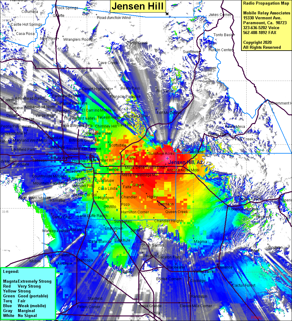 Jensen Hill Coverage |
| Latitude: | 033 26 44.2N | 33.4456111 |
| Longitude: | 111 37 21.5W | -111.6226389 |
| Feet | Meters | |
| Ground Elevation: | 2066.9 | 630.0 |
| HAAT: | 405.6 | 123.6 |
| City: | Mesa | |
| County: | Maricopa | |
| State: | Arizona |
This is not an MRA Owned Site. For space rental contact the site owner.
Do you own or manage this site? Click Here
Would you like to add a site to the Google Earth Map?? Click Here
Site Coverage: Coverage of Mesa, Tempe, Lehi, Guadalupe, Scottsdale, Phoenix, Paradise Valley, Chimney Hill, Rio Verde, Fort McDowell, Higley, Queen Creek, Chandler Heights, Sun Lakes, Snaketown, Casa Blanca, Baychule, Maricopa, Stanfield, Peters Corner, Randolph, Magma, Florence Jct, Cactus Forest, Fountain Hills, Coolidge, Ak Chin, Mobile, Santa Cruz, Avondale, Litchfield Park