Juniper Mtn
| Site Name: | Juniper Mtn | 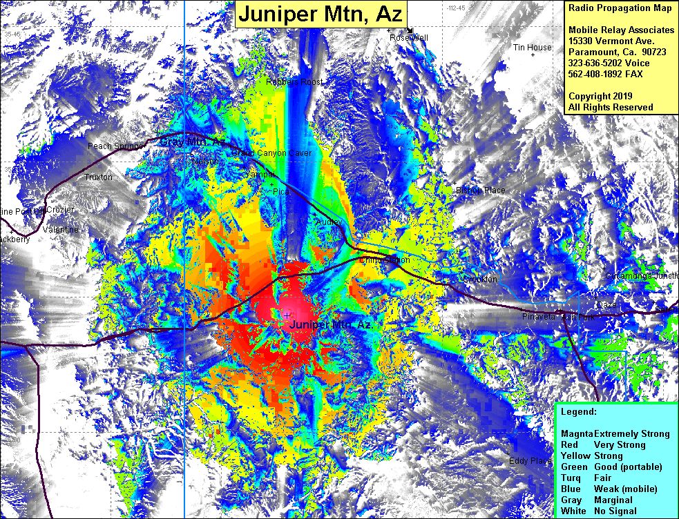 Juniper Mtn Coverage |
| Latitude: | 035 12 55.6N | 35.2154444 |
| Longitude: | 113 06 07.2W | -113.1020000 |
| Feet | Meters | |
| Ground Elevation: | 6612.9 | 2015.6 |
| HAAT: | 1109.4 | 338.1 |
| City: | Seligman | |
| County: | Yavapai | |
| State: | Arizona |
This is not an MRA Owned Site. For space rental contact the site owner.
Do you own or manage this site? Click Here
Would you like to add a site to the Google Earth Map?? Click Here
Site Coverage: Coverage of Yampai, Pico, Audley, Chino Stn, Seligman, Crookton, Pinaveta, Pico, Grand Cyn Caver, Robbers Roost, Frazier Wells, Antares, Hackberry, Truxton, Abra, Paulden, Eddy Place, Wild Cow Campground, Pica, Nelson, Bishop Place, Cucamonga Junction, Anita Station