Kendrick Peak
| Site Name: | Kendrick Peak | 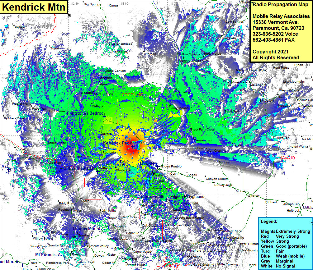 Kendrick Peak Coverage |
| Latitude: | 035 24 29.0N | 35.4080556 |
| Longitude: | 111 51 02.7W | -111.8507500 |
| Feet | Meters | |
| Ground Elevation: | 10353.0 | 3,155.6 |
| HAAT: | 2787.9 | 849.8 |
| City: | Bellemont | |
| County: | Coconino | |
| State: | Arizona |
This is not an MRA Owned Site. For space rental contact the site owner.
Do you own or manage this site? Click Here
Would you like to add a site to the Google Earth Map?? Click Here
Site Coverage: Coverage of Flagstaff, Cogdill Center, Mountainaire, Rockledge, Lakeview, Pilgrim Playground, Lakeview, Coyote Basin Ranch, Stoneman Lake, Whitted Place, Hamilton Crossing, Lower Tillman, Macks Crossing, Kinder Crossing, Wiggins Crossing, Echinique Place, Wingfield, Long Valley, Clints Well, Rimrock, Lawrence Crossing, Bridgeport, Clarkdale, Prescott Valley, Prescott, Granite Basin, Granite, Tutt, Del Rio, Paulden, Abra, Eddy Place, Drake, Pinaveta, Crookton, Chino Station, Bishop Place, Tin House, Willaha, Woodin, Anita Station, Apex, Coconino, Grand Canyon, Cameron, Gray Mountain, Black Falls Crossing, Dennehotso, Tolchico, Wolf Crossing, Tolani, Sunrise, Sand Springs, Coal Mine Mesa, Huck Ovi, Old Oraibi, Tewa, Wepo, Navajo Gospel Mission, Hard Rocks, Willow Springs, Moenave, Tuba City, Rare Metals, Vista Encantada, North Rim, Red Lake, Cow Springs