Mule Mtn
| Site Name: | Mule Mtn | 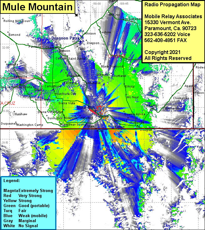 Mule Mtn Coverage |
| Latitude: | 031 28 19.7N | 31.4721389 |
| Longitude: | 109 57 16.5W | -109.9545833 |
| Feet | Meters | |
| Ground Elevation: | 7006.0 | 2,135.4 |
| HAAT: | 2072.7 | 631.8 |
| City: | Bisbee | |
| County: | Cochise | |
| State: | Arizona |
This is not an MRA Owned Site. For space rental contact the site owner.
Do you own or manage this site? Click Here
Would you like to add a site to the Google Earth Map?? Click Here
Site Coverage: Coverage of Black Bear Spring, Stark, Naco, Hereford, Ramsey, Bledsoe, Sierra Vista Estates, Signal Village, Sierra Vista, Bonoita, Elgin, Greaterville, Panteno, Chamiso, Benson, Sibyl, Tully, Curtiss, Saint David, Boquillas, Fairbank, Tombstone, Lewis, Charleston, Fairbank, Gleason, Black Diamond, Courtland, Elfrida, McNeal, Double Adobe, Forrest, Sunizona, Don Luis, Cazador, Kansas Settlement, Cochise, Willcox, Raso, Dos Cabezas