Oatman Mtn
| Site Name: | Oatman Mtn | 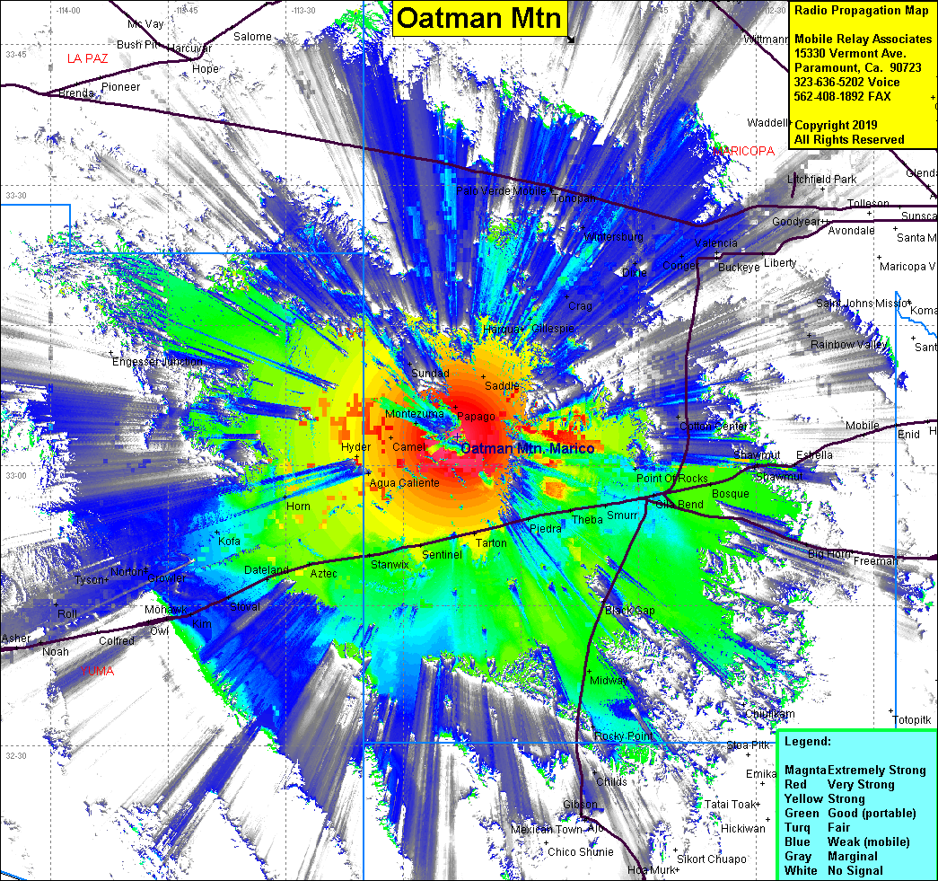 Oatman Mtn Coverage |
| Latitude: | 033 03 06.2N | 33.0517222 |
| Longitude: | 113 08 07.7W | -113.1354722 |
| Feet | Meters | |
| Ground Elevation: | 1,732.3 | 528.0 |
| HAAT: | 1,096.5 | 334.2 |
| City: | Gila Bend | |
| County: | Maricopa | |
| State: | Arizona |
This is not an MRA Owned Site. For space rental contact the site owner.
Do you own or manage this site? Click Here
Would you like to add a site to the Google Earth Map?? Click Here
Site Coverage: Coverage of Gila Bend, Agua Caliente, Stoval, Aztec, Sentinel, Tarton, Piedra, Theba, Smurr, Saddle, Carriel, Sundad, Gillespie