Oatman Mtn, Mojave
| Site Name: | Oatman Mtn, Mojave | 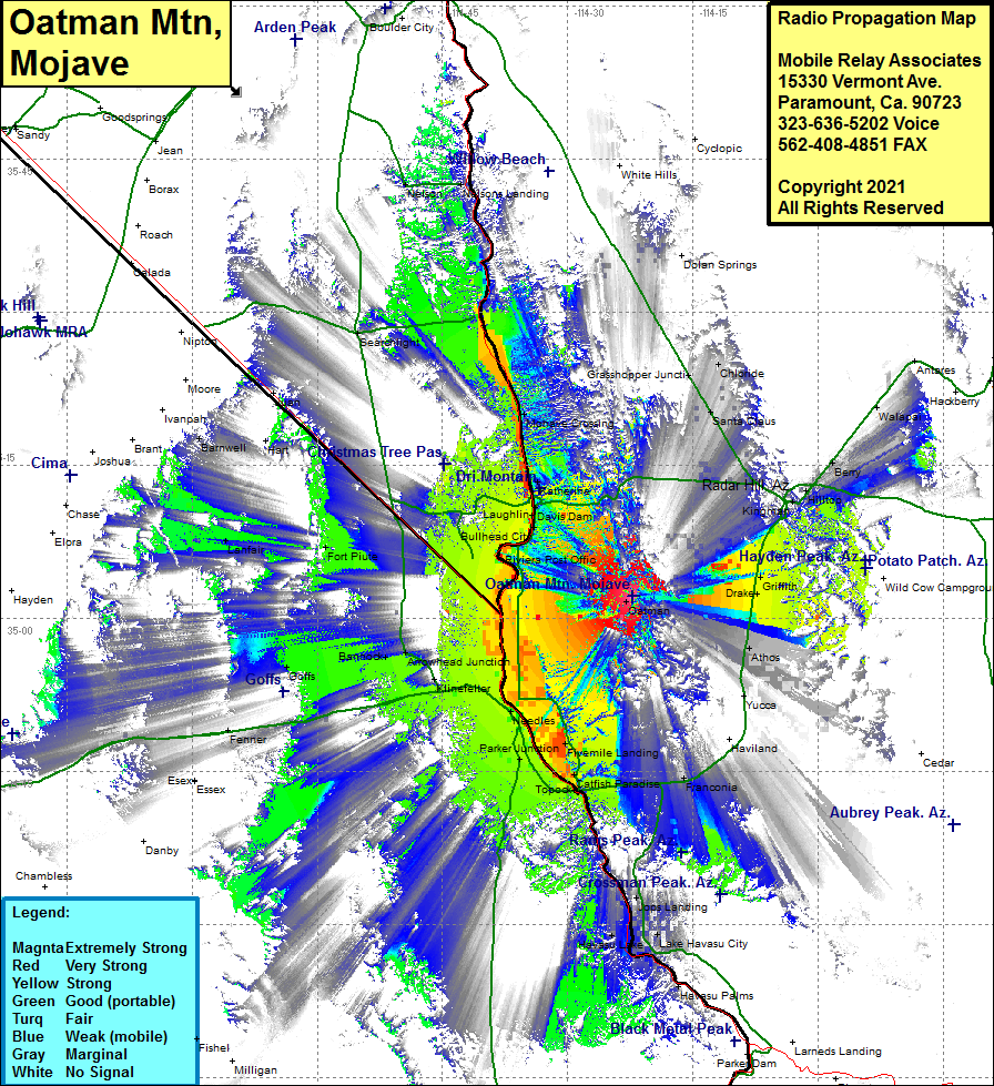 Oatman Mtn, Mojave Coverage |
| Latitude: | 035 02 07.0N | 35.0352778 |
| Longitude: | 114 22 12.5W | -114.3701389 |
| Feet | Meters | |
| Ground Elevation: | 4049.0 | 1,234.1 |
| HAAT: | 1578.9 | 481.3 |
| City: | Oatman | |
| County: | Mojave | |
| State: | Arizona |
This is not an MRA Owned Site. For space rental contact the site owner.
Do you own or manage this site? Click Here
Would you like to add a site to the Google Earth Map?? Click Here
Site Coverage: Coverage of Fort Piute, Lanfair, Riviera Post Office, Riveria, Barnwell, Hart, Juan, Searchlight, Laughlin, Bullhead City, Davis Dam, Nelsons Landing, Mojave Crossing, Grasshopper Junction, Katherine, Santa Claus, Cerbat, Stockton, Kingman, Hilltop, Berry, Walapai, Antares, Harris, Griffith, Drake, Athos, Yucca, Franconia, Catfish Paradise, Fivemile Landing, Parker Junction, Needles, Fenner, Goffs, Bannock, Arrowhead Junction, Klinefelter, Colorado River Basin