Pinal
| Site Name: | Pinal | 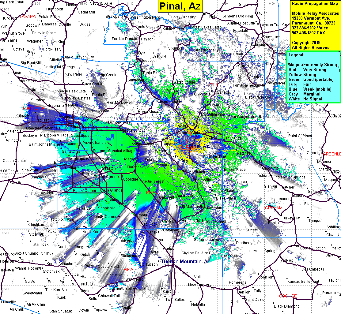 Pinal Coverage |
| Latitude: | 033 16 56.1N | 33.2822500 |
| Longitude: | 110 49 16.3W | -110.8211944 |
| Feet | Meters | |
| Ground Elevation: | 7,854.3 | 2,394.0 |
| HAAT: | 3,519.8 | 1,072.8 |
| City: | Bellevue | |
| County: | Gila | |
| State: | Arizona |
This is not an MRA Owned Site. For space rental contact the site owner.
Do you own or manage this site? Click Here
Would you like to add a site to the Google Earth Map?? Click Here
Site Coverage: Coverage of Bellvue, Florenge, Magma, Gilbey, Casa Grande, Arizona City, Casa Del Oro, Calva, Willow, Tonto Basin