Porter Mtn
| Site Name: | Porter Mtn | 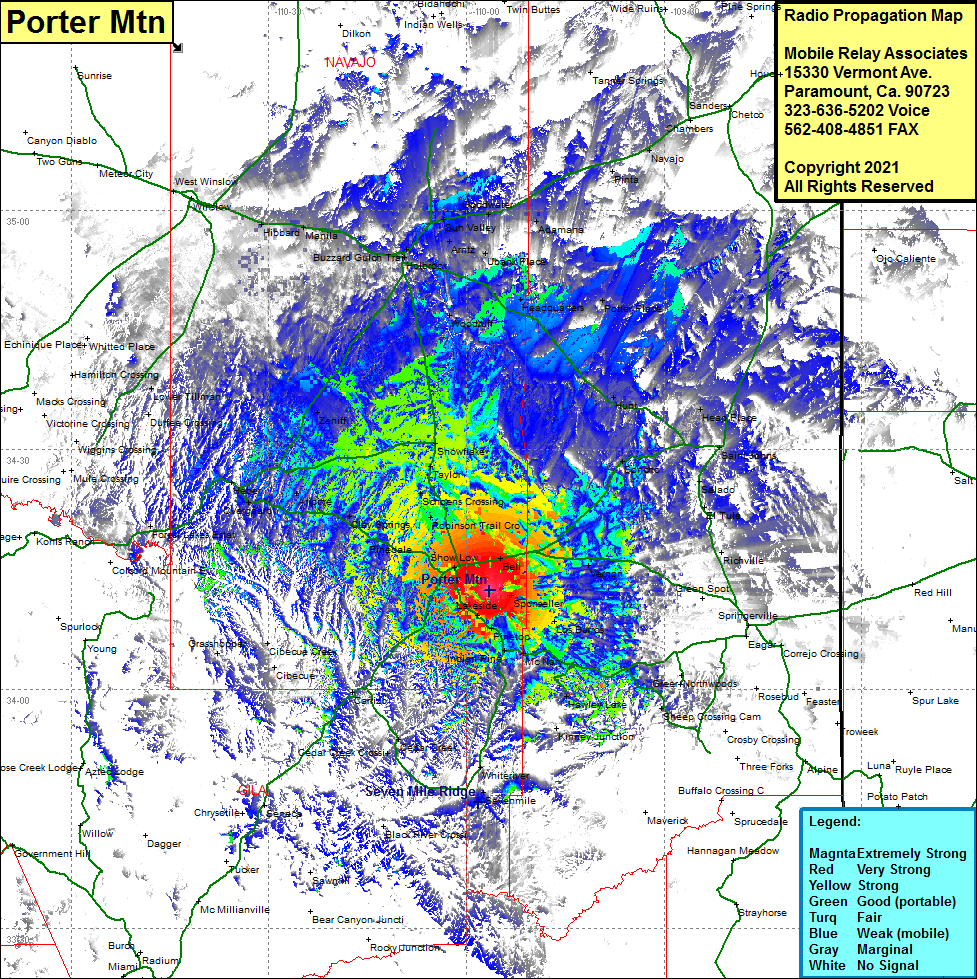 Porter Mtn Coverage |
| Latitude: | 034 12 21.2N | 34.2058889 |
| Longitude: | 109 56 34.1W | -109.9428056 |
| Feet | Meters | |
| Ground Elevation: | 7596.0 | 2,315.3 |
| HAAT: | 874.2 | 266.4 |
| City: | Show Lo | |
| County: | Navajo | |
| State: | Arizona |
This is not an MRA Owned Site. For space rental contact the site owner.
Do you own or manage this site? Click Here
Would you like to add a site to the Google Earth Map?? Click Here
Site Coverage: Coverage of Show Low, Roundy Crossing, Robinson Trail Crossing, Burton, Schoans Crossing, Taylor, Snowflake, Linden, Pinedale, Aripine PO, Aripine, Overgaard, Hebar, Zeniff, Woodruff, Ubank Place, Paulcell Place, Goodwater, Adamana, Headquarters, Potter Place, Sun Valley, Penzance, Joseph City, Manila, Hibbard, Arntz, Goodwater, Adamana, Ubank Place, Potter Place, Hunt, Heap Place, Concho, Saint Johns, Vernon, Los Burros, Sponseller, Pinetop, Indian Pine, McNary, Hawley Lake, Diamond Creek Jct, Cedar Creek