Potato Patch
| Site Name: | Potato Patch | 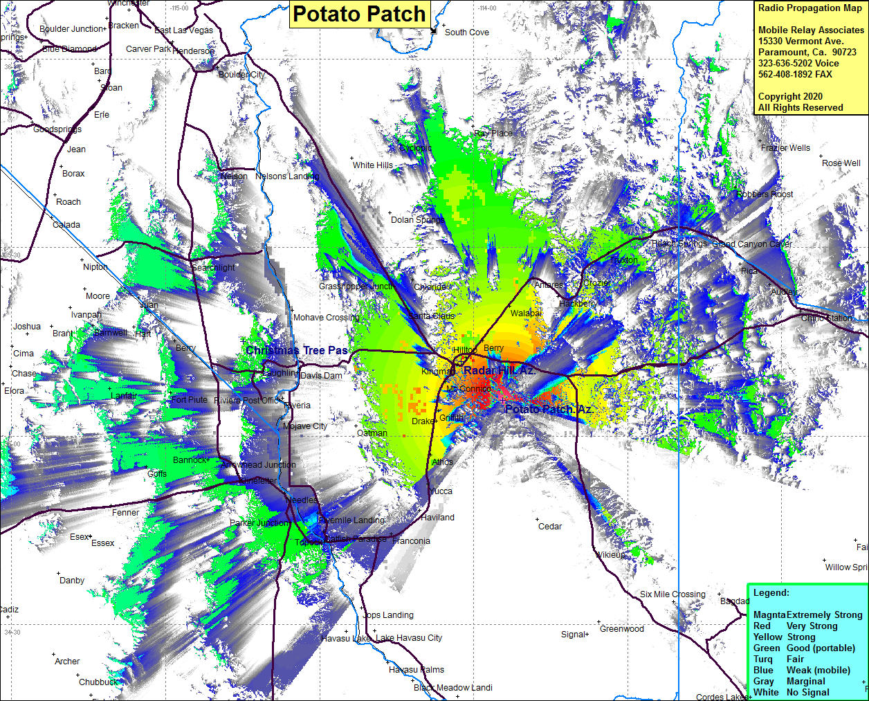 Potato Patch Coverage |
| Latitude: | 035 05 38.9N | 35.0941389 |
| Longitude: | 113 54 20.3W | -113.9056389 |
| Feet | Meters | |
| Ground Elevation: | 7700.1 | 2347.0 |
| HAAT: | 2958.3 | 901.7 |
| City: | Kingman | |
| County: | Mojave | |
| State: | Arizona |
This is not an MRA Owned Site. For space rental contact the site owner.
Do you own or manage this site? Click Here
Would you like to add a site to the Google Earth Map?? Click Here
Site Coverage: Coverage of Kingman, Hilltop, Berry, Walapai, Antares, Wild Cow Campground, McConnico, Griffith, Drake, Athos, Yucca, Haviland, Franconia, Powell, Catfish Paradise, Powell, Fivemile Landing, Parker Junction, Needles, Java, Ibis, Bannock, Lanfair, Fort Piute, Searchlight, Berry, Mojave Crossing, Grasshopper Jct, Chloride, Nelson, Valentine, Truxton, Peach Springs, Grand Canyon Caver, Audley