Radar Hill
| Site Name: | Radar Hill | 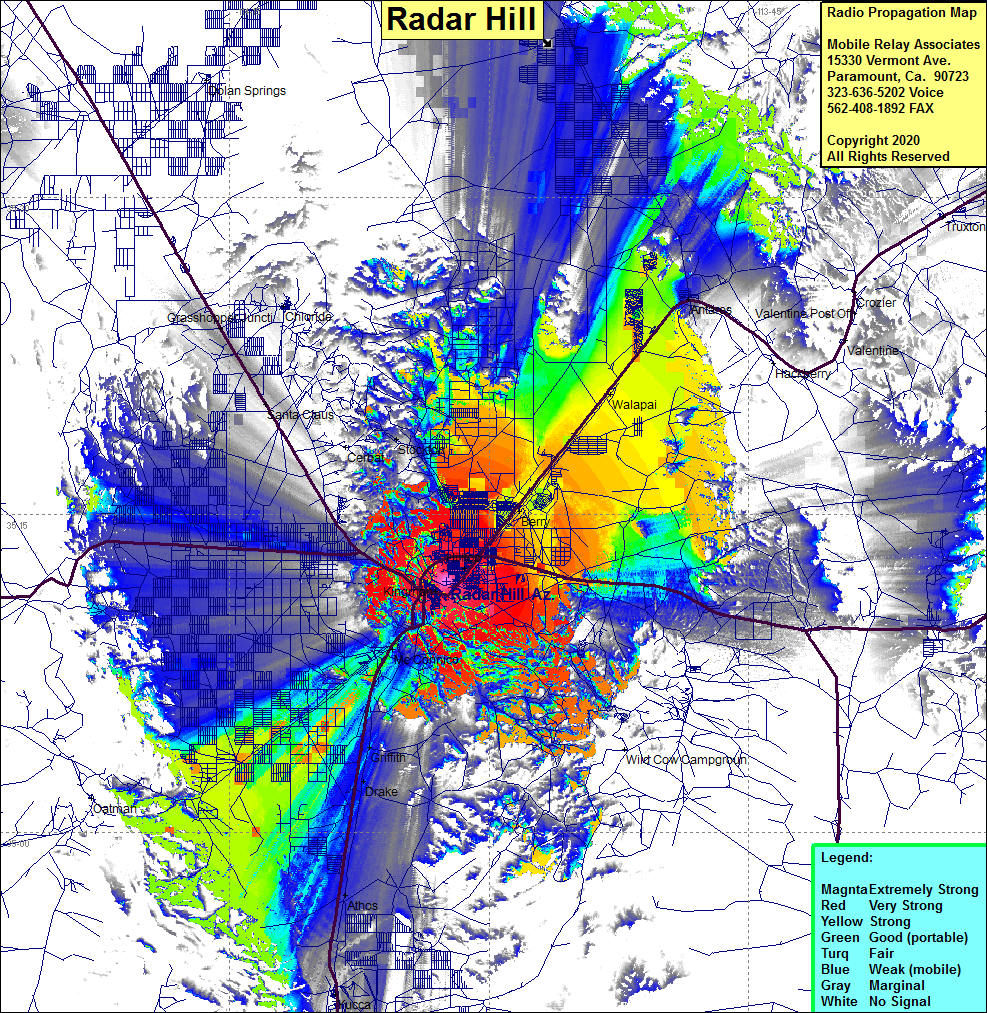 Radar Hill Coverage |
| Latitude: | 035 11 51.3N | 35.1975833 |
| Longitude: | 114 02 29.1W | -114.0414167 |
| Feet | Meters | |
| Ground Elevation: | 3773.0 | 1150.0 |
| HAAT: | 239.2 | 72.9 |
| City: | Kingman | |
| County: | Mojave | |
| State: | Arizona |
This is not an MRA Owned Site. For space rental contact the site owner.
Do you own or manage this site? Click Here
Would you like to add a site to the Google Earth Map?? Click Here
Site Coverage: Coverage of the Kingman, Arizona area, Interstate 40 from Yucca to the eastern junction of Hwy 93, Highway 66 northeast through Walapai to Antares, Berry, Walapai, Hilltop, Stockton, Santa Claus, Griffith, Drake, Athos, Fivemile Landing, Catfish Paradise