Shawbutte
| Site Name: | Shawbutte | 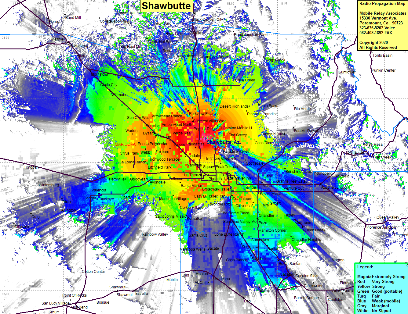 Shawbutte Coverage |
| Latitude: | 033 35 40.1N | 33.5944722 |
| Longitude: | 112 05 14.5W | -112.0873611 |
| Feet | Meters | |
| Ground Elevation: | 2119.4 | 646.0 |
| HAAT: | 931.3 | 283.9 |
| City: | Phoenix | |
| County: | Maricopa | |
| State: | Arizona |
This is not an MRA Owned Site. For space rental contact the site owner.
Do you own or manage this site? Click Here
Would you like to add a site to the Google Earth Map?? Click Here
Site Coverage: Coverage of Phoenix, Scottsdale, Youngtown, Arrowhead Ranch, Wittmann, Circle City, Morristown, Allah, Vickenburg, Buckeye, Conger, Dixie, Wintersburg, Crag, Guadalupe, Chandler, Ranch, Shaketown, Tempe, Chandler Heights, Apache Junction, Sunshine Acres, Desert Highlands, Cave Creek, Reata Pass, Hamburg, Packer, Burro John, Heaton, Maricopa, Ak Chin