Smith Peak
| Site Name: | Smith Peak | 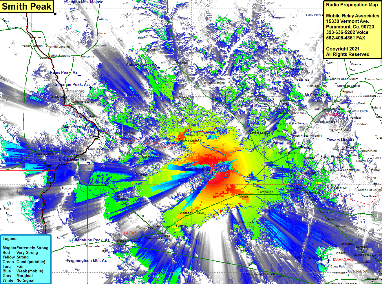 Smith Peak Coverage |
| Latitude: | 034 03 55.0N | 34.0652778 |
| Longitude: | 113 21 20.0W | -113.3555556 |
| Feet | Meters | |
| Ground Elevation: | 5240.0 | 1,597.2 |
| HAAT: | 2772.8 | 845.1 |
| City: | Wenden | |
| County: | La Paz | |
| State: | Arizona |
This is not an MRA Owned Site. For space rental contact the site owner.
Do you own or manage this site? Click Here
Would you like to add a site to the Google Earth Map?? Click Here
Site Coverage: Coverage of Aguils, Gladden, Wenden, Love, Salome, Harcuvar, Hope, Bush Pit, McVay, Utting, Bouse, Vicksburg Jct, Desert Wells, Pioneer, Brenda, Forepauch, Wickenburg, Morristown, Wittmann, Suh City West, Parkview Estates, Wild Flower, Mathie, Congress Jct, Kirkland Jct, Cordes Lakes, Date, Browns Crossing, Signal, Greenwood, Bagdad, Planet, Poston, Mesaville, Lake Havasu City, Haviland, Wood Trap, Willow Spring, Ambrosia Mill, Palo Verde Mobile, Tonopah, WIntersburg, Dixie, Buckeye, Gillespie, Crag, Harqua