Usary Pass
| Site Name: | Usary Pass | 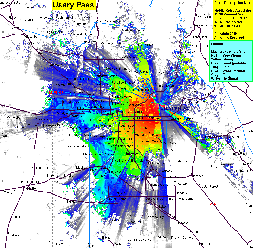 Usary Pass Coverage |
| Latitude: | 033 29 30.0N | 33.4916667 |
| Longitude: | 111 38 26.9W | -111.6408056 |
| Feet | Meters | |
| Ground Elevation: | 2,521.0 | 768.4 |
| HAAT: | 921.6 | 280.9 |
| City: | Apache Junction | |
| County: | Maricopa | |
| State: | Arizona |
This is not an MRA Owned Site. For space rental contact the site owner.
Do you own or manage this site? Click Here
Would you like to add a site to the Google Earth Map?? Click Here
Site Coverage: Coverage of Maricopa, Chandlier Heights, Apache Jct, Harmony, Scottsdale, Paradise Valley, Preston Hills, Guadalupe, Phoenix