Yarnell Hill
| Site Name: | Yarnell Hill | 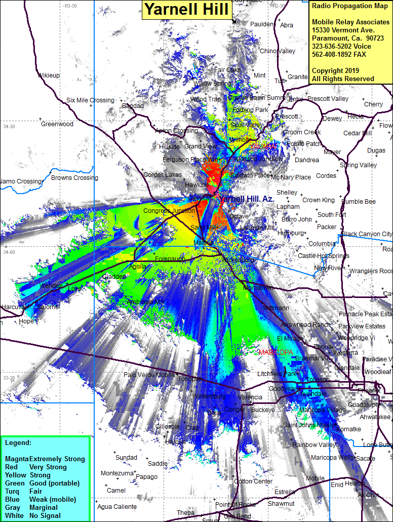 Yarnell Hill Coverage |
| Latitude: | 034 12 58.7N | 34.2163056 |
| Longitude: | 112 44 37.3W | -112.7436944 |
| Feet | Meters | |
| Ground Elevation: | 5255.9 | 1602.0 |
| HAAT: | 1175.0 | 358.1 |
| City: | Yarnell | |
| County: | Yavapai | |
| State: | Arizona |
This is not an MRA Owned Site. For space rental contact the site owner.
Do you own or manage this site? Click Here
Would you like to add a site to the Google Earth Map?? Click Here
Site Coverage: Coverage of Yarnell, Peeples Valley, Stanton, Forepaugh, Matthie, Wickenburg, Wickenburg, Allah, Morristown, Circle City, Wittman, Ambrosia Mill, Gladden, Aguila, Congress Jct, Hawkins, Piedmont, Date, Kirkland Junction, Wilhoit, Kirkland, Grand View, Skull Valley, Ponderosa Park