Alamosa II
| Site Name: | Alamosa II | 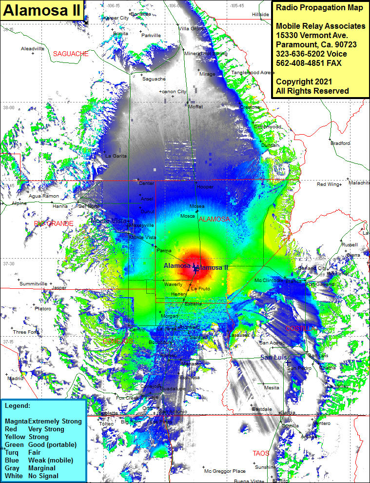 Alamosa II Coverage |
| Latitude: | 037 28 10.2N | 37.4695000 |
| Longitude: | 105 52 50.5W | -105.8806944 |
| Feet | Meters | |
| Ground Elevation: | 7549.0 | 2300.9 |
| HAAT: | 137.7 | 42.0 |
| City: | Alamosa | |
| County: | Alamosa | |
| State: | Colorado |
This is not an MRA Owned Site. For space rental contact the site owner.
Do you own or manage this site? Click Here
Would you like to add a site to the Google Earth Map?? Click Here
Site Coverage: Coverage of Alamosa, Waverly, La Fruto, Mc Clinton, Morgan, Estrella, Richfield, Stanford, Romeo, Manassa, Espinosa, Guadalupe, San Antonio, Paisaje, Sublette, Los Pinos, Lasauses, San Luis, La Valley, Monte Vista, Dunul, Ansel, Center, Hooper, La Garita, Canon, Moffat, Saguache, Mirage, Crestone, Cottonwood, Duncan, Mineral Hot Spring