Avondale
| Site Name: | Avondale | 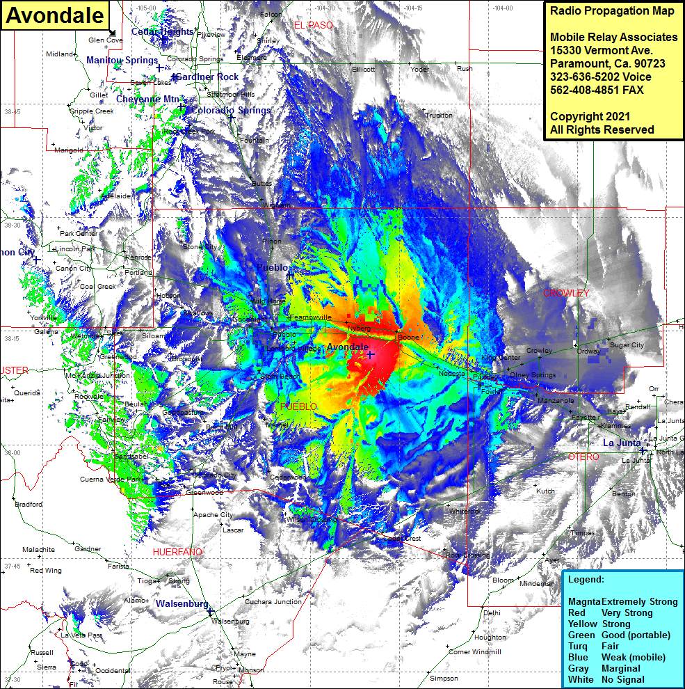 Avondale Coverage |
| Latitude: | 038 11 57.2N | 38.1992222 |
| Longitude: | 104 19 52.1W | -104.3311389 |
| Feet | Meters | |
| Ground Elevation: | 4712.0 | 1436.2 |
| HAAT: | 169.4 | 51.6 |
| City: | Avondale | |
| County: | Pueblo | |
| State: | Colorado |
This is not an MRA Owned Site. For space rental contact the site owner.
Do you own or manage this site? Click Here
Would you like to add a site to the Google Earth Map?? Click Here
Site Coverage: Coverage of Avondale, Nyberg, Fearnowville, North Avondale, Lombard Village, Vineland, Devine, Baxter, Blende, Salt Creek, Pueblo, Goodnight, Eden, Swallows, Wild Horse, Pinon, Wigwam, Buttes, Fountain, Rock Creek Park, Truckton, Ellicott, Yoder, Sugar City, Ordway, Crowley, King Center, Olney Springs, Nepasta, Hamlet, Puttney, Fowler, Elder, Manzanola, Vraman, Fayette, Rocky Ford, Krammes, Newdale, Swink, Ihugo, Hawley, Ormega, North La Junta, Benton, Kutch, Cedarwood, Marnel, Stem Beach, Cuerna Verde Park, Rye, Colorado City, Bronquist, Siloam, Sikes