Black Ridge
| Site Name: | Black Ridge | 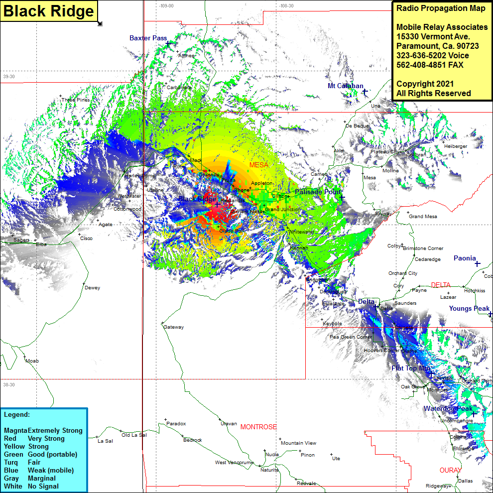 Black Ridge Coverage |
| Latitude: | 039 03 59.3N | 39.0664722 |
| Longitude: | 108 44 43.4W | -108.7453889 |
| Feet | Meters | |
| Ground Elevation: | 7083.0 | 2158.9 |
| HAAT: | 1269.6 | 387.0 |
| City: | Redlands | |
| County: | Mesa | |
| State: | Colorado |
This is not an MRA Owned Site. For space rental contact the site owner.
Do you own or manage this site? Click Here
Would you like to add a site to the Google Earth Map?? Click Here
Site Coverage: Coverage of Loma, Mack, Ruby, Harley Dome, Utaline, Westwater, Cottonwood, Cisco, Fruita, Rhone, Appleton, Redlands, Rosevale, Johnsons Corner, Orchard Mesa, Clifton, Mount Lincoln, Cameo, Glade Park, Whitewater, Kennah, Roubideau, Vista, Delta, Chipeta, Pea Green Corner, Olathe, Hoovers Corner