Breckenridge II
| Site Name: | Breckenridge II | 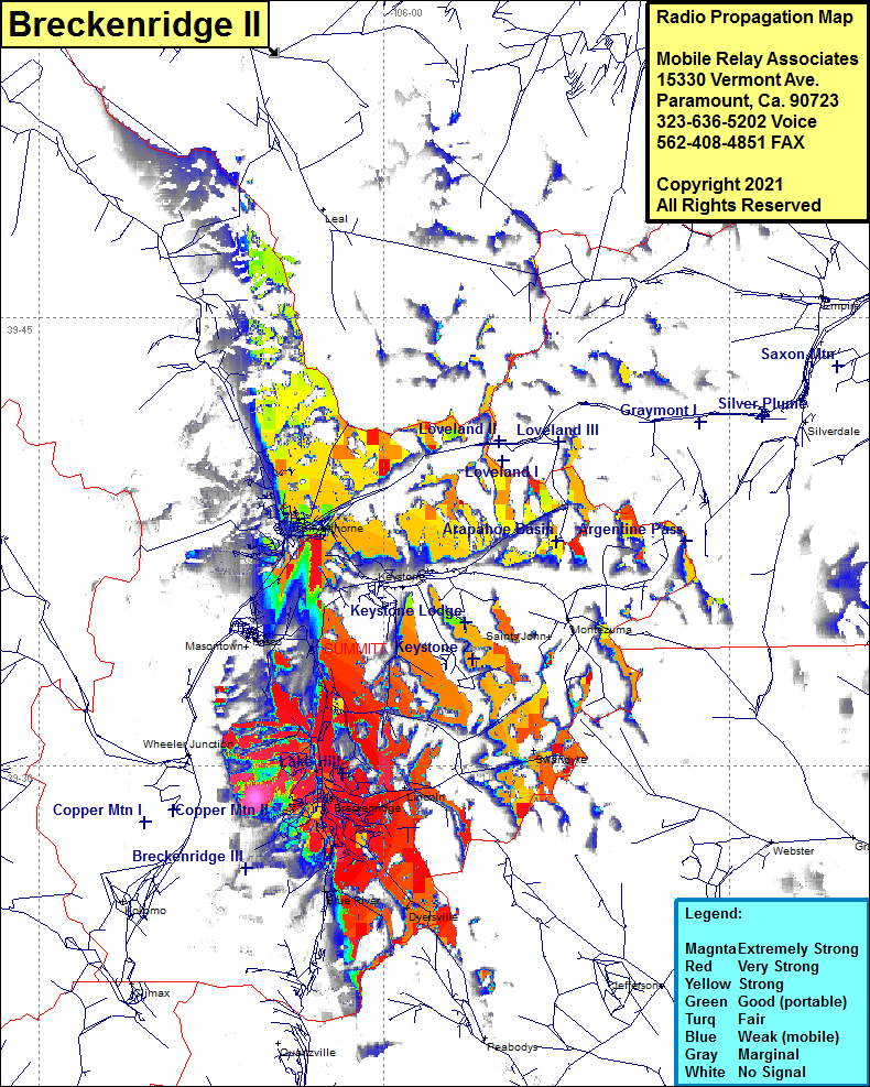 Breckenridge II Coverage |
| Latitude: | 039 28 54.8N | 39.4818889 |
| Longitude: | 106 05 38.3W | -106.0939722 |
| Feet | Meters | |
| Ground Elevation: | 11417.0 | 3479.9 |
| HAAT: | 645.3 | 196.7 |
| City: | Breckenridge | |
| County: | Summit | |
| State: | Colorado |
This is not an MRA Owned Site. For space rental contact the site owner.
Do you own or manage this site? Click Here
Would you like to add a site to the Google Earth Map?? Click Here
Site Coverage: Coverage of Breckenridge, Blue River, Dyersville, Lincoln, Swandyke, Silverthorne, Keystone, Frisco, Colorado Highway 9 from north of Quartzville to north of Silverthorne