Buchanan
| Site Name: | Buchanan | 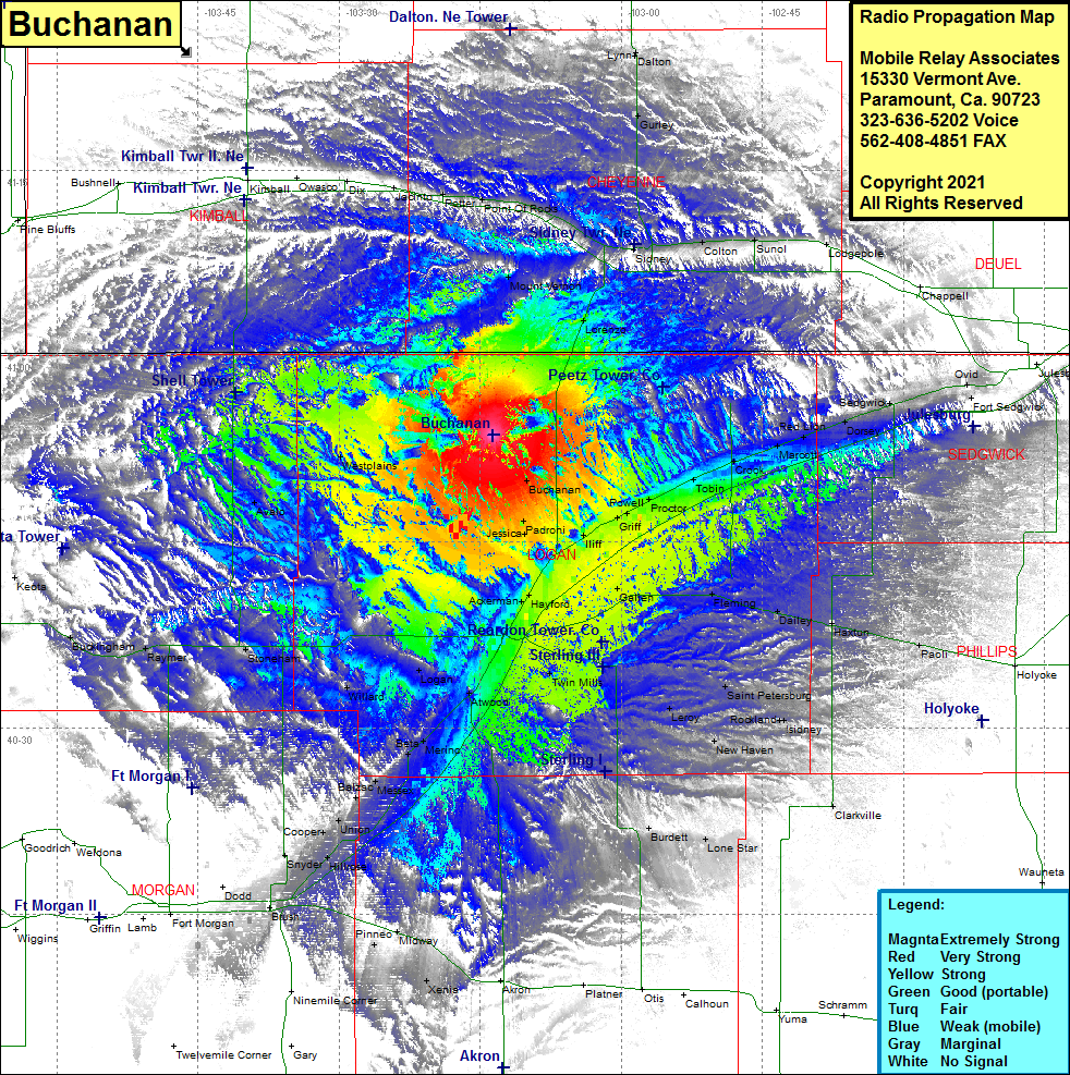 Buchanan Coverage |
| Latitude: | 040 53 37.0N | 40.8936111 |
| Longitude: | 103 13 40.1W | -103.2278056 |
| Feet | Meters | |
| Ground Elevation: | 4592.0 | 1399.6 |
| HAAT: | 416.1 | 126.8 |
| City: | Buchanan | |
| County: | Logan | |
| State: | Colorado |
This is not an MRA Owned Site. For space rental contact the site owner.
Do you own or manage this site? Click Here
Would you like to add a site to the Google Earth Map?? Click Here
Site Coverage: Coverage of Buchanan, Jacinto, Potter, Point Of Rocks, Brownson, Mount Vernon, Lorenzo, Sidney, Gurley, Dalton, Lynn, Colton, Sunol, Lodgepole, Sedgwick, Dorsey, Red Lion, Marcott, Crook, Tobin, Proctor, Powell, Selma, Griff, Iliff, Padroni, Jessca, Galien, Fleming, Dailey, Haxtun, Paoli, Saint Petersburg, Rockland, !sidney, New Haven, Leroy, Clarkville, Lone Star, Burdell, Twin Mills, Hayford, Ackerman, Atwood, Logan, Willard, Beta, Merino, Balzac, Messex, Union, Cooper, Snyder, Stoneham, Avalo, Westplains, Raymer, Buckingham