Buckhorn Mtn
| Site Name: | Buckhorn Mtn |  Buckhorn Mtn Coverage |
| Latitude: | 040 37 00.0N | 40.6166667 |
| Longitude: | 105 19 41.0W | -105.3280556 |
| Feet | Meters | |
| Ground Elevation: | 8305.0 | 2531.4 |
| HAAT: | 1218.0 | 371.2 |
| City: | Bellvue | |
| County: | Larimer | |
| State: | Colorado |
This is not an MRA Owned Site. For space rental contact the site owner.
Do you own or manage this site? Click Here
Would you like to add a site to the Google Earth Map?? Click Here
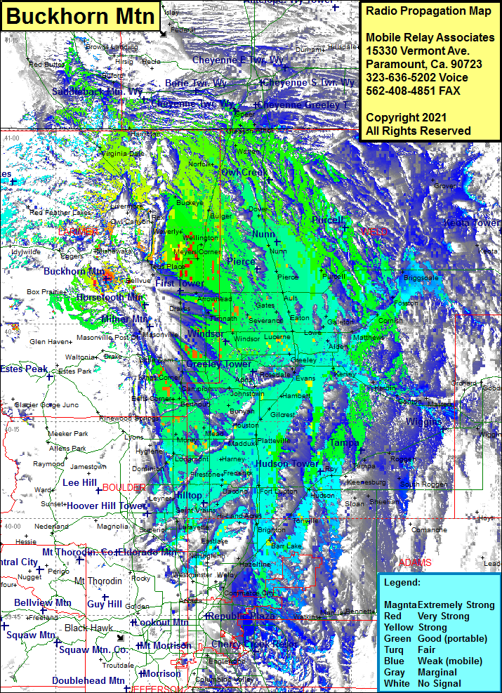
Site Coverage: Coverage of the front range from the Wyoming border heading south through Denver including the towns of Henderson, Brighton, Barr Lake, Powars, Tonville, Fort Lupton, Ione, Platteville, Maddux, Harney, Frederick, Firestone, Lafayette, Longmont, Jessum, Liberty, Morey, Mead, Gowanda, Houston, WIldcat, Highland Lake, Walker, Bunyan, Dent, Gilcrest, Berts Corner, Bethoud, Canpion, Buda, Elwell, Johnstown, Hardman, Hambert, La Salle, Elm, Evans, Augurn, Kersey, Matthews, Cornish, Fosston, Briggsdale, Galeton, Lowe, Lucerne, Mason Corner, Farmers, Greeley, Cloverly, Alden, Timnath, Harmony, Trilby Corner, Omega, Drakes, Fort Collins, Kluver, Ault, Pierce, Purcell, Nunn, Dover, Meyers Corner, Wellington, Waverly, Dixon, Bulger, Norfolk, Warren, Gleason, Athol, Harriman, Virginia Dale, Livermore, Rex, Owl Canyon, Buckeye, Bellvue
