Castle Peak
| Site Name: | Castle Peak | 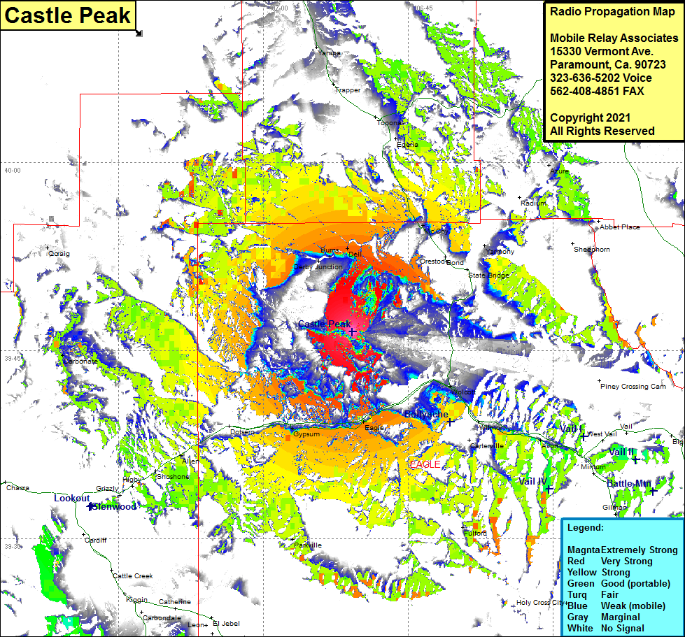 Castle Peak Coverage |
| Latitude: | 039 46 30.2N | 39.7750556 |
| Longitude: | 106 50 47.0W | -106.8463889 |
| Feet | Meters | |
| Ground Elevation: | 11038.0 | 3364.4 |
| HAAT: | 2893.9 | 882.0 |
| City: | Eagle | |
| County: | Eagle | |
| State: | Colorado |
This is not an MRA Owned Site. For space rental contact the site owner.
Do you own or manage this site? Click Here
Would you like to add a site to the Google Earth Map?? Click Here
Site Coverage: Coverage of Derby Junction, Burns, Dell, McCoy, Egeria, Yarmony, Azure, Wolcott, Wilmor, Avon, Dowds Junction, Minturn, Gilman, Fulford, Eagle, Gypsum, Dotsero, Allen, Shoshone, Higby, Carbonate, Qcraig