Cedar Heights
| Site Name: | Cedar Heights | 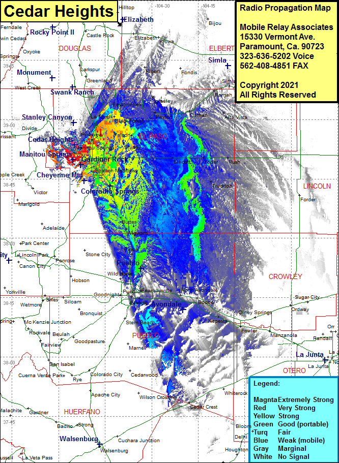 Cedar Heights Coverage |
| Latitude: | 038 53 35.2N | 38.8931111 |
| Longitude: | 104 54 48.0W | -104.9133333 |
| Feet | Meters | |
| Ground Elevation: | 7931.0 | 2417.4 |
| HAAT: | 66.5 | 20.3 |
| City: | Colorado Springs | |
| County: | El Paso | |
| State: | Colorado |
This is not an MRA Owned Site. For space rental contact the site owner.
Do you own or manage this site? Click Here
Would you like to add a site to the Google Earth Map?? Click Here
Site Coverage: Coverage of Glen Eyie, Pikeview, Papeton, Knob Hill, Elesmere, Shirley, Falcon, La Foret, Black Forest, Ramah, Calhan, Peyton, Ellicot, Yoder, Truckton, Rush, Alta Vista, Beck Sand Draw Crossing, Stratmoor Hills, Security, Widefield, Fountain, Buttes, Wigwam, Henkel, Rock Creek Park, Pinon, Bragdon, Fearnowville, Devine, Nyberg, North Avondale, Avondale, Boone, Vinland, Lombard Village, Pueblo, Nepesta, Hamlet, Fowler, Lombard Village