Centennial
| Site Name: | Centennial | 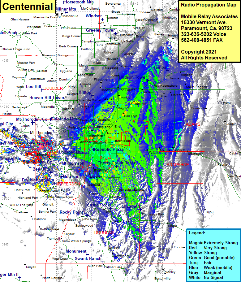 Centennial Coverage |
| Latitude: | 039 45 56.9N | 39.7658056 |
| Longitude: | 105 21 59.2W | -105.3664444 |
| Feet | Meters | |
| Ground Elevation: | 8406.0 | 2562.1 |
| HAAT: | 536.2 | 163.4 |
| City: | Golden | |
| County: | Jefferson | |
| State: | Colorado |
This is not an MRA Owned Site. For space rental contact the site owner.
Do you own or manage this site? Click Here
Would you like to add a site to the Google Earth Map?? Click Here
Site Coverage: Coverage of Cottonwood, Interstate 70 from Argo Mill heading west into Denver, front range including Denver, Lakewood, Alamo Placita, Greenwood Mill, Aurora, Sable, Magee, Montbello, Sandown, Commerce City, Irondale, Rolla, Hazeltine, Henderson Barr Lake, Brighton, Powars, Lupton, Westminster, Welby, Arvada, Spivak, Zuni